Sunday, August 3, 2008

Back To Pine

The east end of Pine Mountain

Sometimes the short flights can be more rewarding than the long ones; Sunday was a good example of that. I headed back to Pine after not flying for over a month. This time it was just me and Tony with Fast Eddie driving. Depending on the weather model the day was supposed to be either very good...or not. Great above the mountains but absolutely terrible on the south end of the Antelope Valley. The difference in the predicted lift tops between the Tehachapis and the valley floor near Lancaster was a whopping 10,000 ft. Never to such an extent, but you often see that kind of variation with strong SW winds; the sea breeze gets sucked right up through Soledad Canyon and spills out onto the desert floor.

The game plan going into the day was simple: get up at launch; head over to Frazier where we expected to get above 15k; fly up the Tehachapis; and either head up the Panamint or Owens Valley depending on how much west wind we encountered when we got to the Garlock area (since my motion sickness would be kicking in at about that time that last part would be Tony's game plan, not mine). Well, the first part worked out. I did get up at launch and I did start making my way to Frazier.

I write in my last post that once you leave launch and head east you have to cross over about 8 miles of unretrievable terrain. Now there's more than one way to make the crossing. One way is to stay on the front side of Pine and then go over the back from the east end of the range where the glide to Grade Valley, the next retrievable LZ, is relatively short. The problem with this route is that as you get further east on Pine the closer you get to Wheeler Gorge and the marine air that seeps through it.

The second route is to go over the back at launch or Reyes Peak, which located just east of take-off, and head over to a long connecting spine on the north side of the mountain known as the Chute. The LZs are on the west end of the Chute so the idea is to probe as far east as you can up the spine while at the same time leaving yourself enough altitude to make it back to the landing areas in case you can't find any lift. However, the winds on the north side of Pine are generally NW so you have to make sure that you don't probe too far east because you will be bucking a head wind on your way back. From the Chute you have a choice of either gliding to Grade Valley or San Guillermo Mtn. If I have the altitude I prefer Grade Valley. There always seems to be thermal just on the east side of the valley, but mostly because it sets you up nicely for a nice down wind shot to Frazier Mtn. Guillermo pumps out the lift too, but flying there puts you a tad north of the thermal generating foothills south of Lockwood Valley.

The third route is to go over the back at launch and head to Dry Canyon, the last landable LZ before the "Badlands." I loathe this route. Mostly because it hardly ever works (for me anyway). But by taking this route you are really only giving yourself one chance to find the lift needed to make the crossing. I recommend that you always try the Chute first. If it doesn't work you can always peel off to Dry Canyon for that one last chance of finding something. That's exactly what happened to me on Sunday.


I left Reyes Peak at 11.5 and made my way up the Chute where I proceeded to not find any lift at all. If I had kept going I probably could have eked into Grade Valley on a glide. But if I didn't find something along the way I would have gotten there too low to take advantage of anything that I might have stumbled on when I arrived. So instead, I turned around and made my way back down the Chute to the west hoping to find something coming up the spine. When I still didn't find anything I peeled off directly north hoping that I might stumble into the convergence. On the drive up it was blowing north almost all the way to the south launch so I figured it had to be out there somewhere. As I probed north I kept checking my ground speed for signs of the NW wind. I ran into it just short of Dry Canyon so I turned around and headed back the other way. It was obvious that I was in converging air, but I simply could not find any cohesive lift. NAM had predicted a 6k inversion layer and it seemed like that was what I was dealing with. I did manage to break though fleetingly to 8k at one point, but that was nowhere near the height I needed to make the crossing. After a bit more searching I threw in the towel and headed to the Dry Canyon spine for that one last chance effort before putting it down. As I would be north of the convergence zone I wasn't expecting much, but as I flew over the spine at around 5600 ft my vario started singing. Soon I was well over 11,000 ft and on my way to Guillermo. Go figure. At Guillermo I had another climb out to the mid twelves and then it was over to Frazier.


Lockwood Valley. Guillermo is the peak at the bottom right-hand corner.


Looking back at Lockwood from Frazier.


Going into the day I thought the tough spot would be Pine itself because of the marine air influence. I figured that if we made it to Frazier we would be well on our way because all of the models were saying that we should see at least 15k tops and cloud development. There were some clouds but they didn't seem like they were the result of any thermal lift. However, I got to Frazier in perfect position and as I zoomed up the SW spine with 50 mph ground speed I prepared to be yanked to the stratosphere. I'm still waiting. I don't think that I have ever been flushed off of Frazier before. But there I was at 6500 ft on the east end of it floundering out toward Hungry Valley.

Frazier with the Antelope Valley in the distance.


Of course, any time that you have a long glide in front of you it is nice to be as high as possible before leaving; it's especially true for the transition from Frazier to the Antelope Valley. The prevailing surface winds here are north as they funnel up and over the Grape Vine from the Central Valley. The most direct route to the Antelope from Frazier is due east to the Tehachapis Mountains, which make up the valley's northern V-shaped border. The problem is that if you're not high enough you will find yourself blown off the mountains in leeside conditions once you get into the valley. Ironically, the lower you leave Frazier the farther south you have to go, and the longer you have to glide in order to give yourself a chance of getting established in the Antelope. It's north along the Grape Vine, but just a few miles into the valley the prevailing winds turn SW. On Sunday that meant we were right smack in the middle of that thermal killing marine air that I wrote about above. But I'm getting ahead of myself.

Looking south down I 5 with Pyramid Lake the distance.

On the ground Eddy was reporting north winds all the way to Quayle Lake, which is located near the start of the Liebre Mountains (the valley's southern border) a few short miles east of Interstate 5. I was hoping to leave the mountains with 15k so that I would be well above all of that lower level north, but instead I was down below 7k and actually flying into a bit of a headwind as the winds were wrapping around the east end of Frazier. Fortunately, the air above Hungry Valley turned out to be be pretty buoyant. Unfortunately, it also wasn't very smooth; my motion sickness problem kicked in a tad earlier than usual. But I fought through it and found myself climbing out to just short of 9k just west of the Interstate near Rte 138, which was actually not that bad of a position to be in in order to drop into Antelope. However, the air just on the other side of the Interstate before the start of the Antelope is generally pretty turbulent; due to the topography it seems like the winds come together here from every direction. This mixing zone usually provides plenty of lift, but because of the way I was feeling I elected to fly through it. That's the thing about feeling lousy: everything becomes half-arse. You would like to fly longer, but you no longer have the motivation to do everything that you can to make it happen; when you fall out of the lift you're working you don't go searching for it again; if lift is turbulent you fly out of it. And that is where my mental state was once I got into the heart of the Antelope. It would have been nice to have flown farther but I was ready to land.

The flight was only 43 miles or so, and of course I was feeling sick at the end of it, but because of the low save at Dry Canyon, and the way I was able to work my way over to the Antelope in relatively good shape from my position at Frazier, it was pretty rewarding none the less.

Tony would end up just short of Mojave.

Tuesday, June 24, 2008

Pine Mountain 6/21

Photos by Bo Criss (from a few years ago) of Circling Hawk and Robb Milley.


Over 100 miles on my last flight, could I make it two in a row? The conditions were certainly conducive for a long one: lift to between 14-15k; nice cloud development; and a 15 knot wind. A Blackhawk to Arizona flight seemed like a good bet, but man, it was supposed to be over 110 degrees out there. The thought of setting up in the heat atop that barren landscape just didn't seem that appealing. At least at a place like Crestline you can find a little relief by setting up in the shade below the pine trees. However, driving all the way out there with a predicted NW wind seemed a bit of a risk. Plus just getting high enough to go over the back into the desert is always a crap shoot even on good days because of the inversion layer. Elsinore had some potential, but that NW would take us away from all of that high stuff out in the desert. Kagel? See above and the discussion about inversion layers. So where to go? The South Coast PG club was hosting a summer solstice fly-in up in Ojai, but in the end we opted for the site that had the greatest potential, Pine Mountain in Ventura County. It was farthest up wind, and even though there is no shade anywhere near launch to provide relief from the heat, images of the surrounding pine forest just made the place seem more inviting.

Looking back at Pine from the NE (Bo Criss)

South Launch (Bo Criss)


Pine really is a beautiful place and one of the best kept secrets in Southern California. At 7,000 ft it offers some pretty unique vistas. Toward the SW you can look out over the Santa Ynez and Topa ranges and see the Pacific ocean with the Channel Islands sitting just offshore; on a clear day even Catalina is visible. To the north, Mt. Abel and Mt. Pinos loom above the "badlands" that stretch out to Cuyuma Valley to the west and Lockwood Valley to the east. Not much to look at under hazy blue skies, but when cumulus clouds are present their shadows make the low lying peaks and valleys stand out and come alive. Of course, that same beautiful topography provides problems when trying to fly XC. Pilots have to cross about 8 miles of unretreivable terrain once they go over the back and head east. Saturday's predicted WNW winds would make the crossing much easier, but launching more problematic.

The Badlands (Bo Criss)


Pine has a south and a north launch so a predominately west wind presents problems getting off of the hill. Just to the right of south launch there is a rather large spine (the Knob) that creates rotoring conditions in a west wind. And the north launch is just plain sketchy, even when it is blowing straight in. Pilots rely on ridge lift conditions in order to make it over to the house thermal located about a half mile or so to the east. A crosswind doesn't help. However, get in the air safely from either launch in a west wind and you're in perfect position for a long flight as you can avoid Edwards' airspace to the south once you get out into the desert

After first meeting up for breakfast with Tony and Carolyn we picked up Robert Millington at the Rite-Aid parking lot in Ventura. Back in the day that used to be the meet spot; we would have 10-15 pilots shuffling gliders every weekend morning making preparations to head up into the mountains. Here it is on one of those days that you dream about and it was just the three of us (having said that, the PGs had close to 20 pilots at there fly-in). Anyway, after stopping for gas in Ojai - Yikes! - we made our way up Hwy 33. It was sometime around 11:00 when we drove past Rose Valley and there was already some cloud development on the backside of Pine.

Robb Milley's photo from the PG fly-in in Ojai. The back sun-lit ridge is the east end of Pine.


Like I said, the prediction was for moderate WNW winds. Because of that, I expected the winds to be blowing fairly strong through the summit gap. But, when we arrived, although still north, the winds were light. Seeing that, I thought to myself, "We're going to be suckered into taking off from the south launch;" not something I was looking forward to.

When we arrived at the north launch it was blowing straight in. But after beginning to set up our gliders we noticed that the clouds had more of a west drift than NW. Also, a nearby portable weather station was showing some puffs up the south side. We decided to pack up and head up to the south launch, which is about a two mile drive up the mountain.

Got up to south launch to find the winds blowing every which way but up. After about 20 minutes of watching more of the same we opted to head back to the north launch to take our chances there. When we arrived after the two mile drive back the other way the winds were dead calm. No one wanted to take off with no wind from that particular launch, but no one was willing to throw in the towel with that beautiful cumulus filled sky above us, so it was back to the south launch again.

This time the winds were consistently blowing out of the west. Of course, not ideal, but if typical, we expected an occasional bout of upslope direction to get us off the hill. And sure enough, as we set up our gliders that is what exactly happened.

Normally in a west wind I turn east immediately after take off rather than head to the house thermal spine to the right of launch. That gets me away from the rotor, but it also gets me away from the south side LZs. Sometimes you just have to pick your poison. Tony took off first and headed right. You could tell that he was in some pretty rowdy air, but he made it work and climbed out above the spine. Robert launched next and turned left like I was planning to do. I was busy getting ready and I so didn't see how far east he had gone, but when I got to launch I could see him floundering back against the headwind to the spine Tony climbed out on.

After backing off from launch for some equipment adjustments, I finally got in the air myself. It was about 2:30. The winds at launch itself weren't all that strong, but I shot straight up into the air once leaving the ground. I once heard Steve Moyes say that when it's all said and done hang gliders are nothing more than leaves in the wind. That is exactly how I felt as I made my way over to the spine to the right of launch after deciding not to head east after watching Robert.

The wind noise made it almost impossible to hear my vario, but I had no intentions of letting up on the base bar. Both Tony and Robert were screaming to 14k by this time. At first I tried to drift up the spine with the lift, but I seemed to be getting more tossed around than anything so I tried extending my circle downwind to the east. When I continued climbing I put the glider on its tip. By the time the lift petered out I was well over 13k and somewhere between Reyes and Haddock Peak.


Normally I would make my way to the "Chute" hoping for one more climb out before crossing the badlands, but with the west wind I just B-lined it straight to Grade Valley. Both Tony and Robert opted to make their way to Frazier Mountain using it as a spring board to the Antelope Valley. They made it work, but with a WNW wind I thought it would be better to stay to the south and fly closer to Alamo Mountain. Besides, Frazier was completely shaded in and there was a sun line just north of Alamo.

Frazier Mountain (Bo Criss)

I had a little climb out above Grade Valley to around 12k and then a big one to 15,350 ft just north of Alamo. By the time I reached Hungary Valley just west of I 5 I was still above 14k and in great shape to drop into the Antelope Valley. It would have been nice to have been through this area earlier in order to take advantage of the clouds lined up above the Elibre Mountains on the south end of the valley, but by the time that I had gotten into position they had already shot their load and were dropping virga. I was forced to take a more northerly route out into the middle of the valley. But, apparently not northerly enough.

Antelope Valley (Bo Criss)


Both Tony and Robert were a few miles ahead and to the north of me. No one was reporting great lift, but they seemed to be doing alright. I, on the other hand, never found anything better than zero sink after leaving the mountains west of I 5. In a last gasp effort to stay in the air I angled low over to Fairmont Butte hoping that the relief would provide some help. When I didn't find anything out in front of the butte I knew that my flight would be over as I would be in the lee once I crossed the top. Of course you never want to give up; I spent the last 3 1/2 miles circling 200 ft off of the deck before finally, well, throwing in the towel and landing (56.89 miles).


Robert would go on to Victorville for a 110 mile flight. Tony? How about a new site RW record with a 208 mile flight to just east of 29 Palms.

Getting home is a story in itself. Let's just say that my head didn't hit my pillow until 4:30 am and leave it at that.

Btw, three pilots set a new site record from Kagel on the same day.

Tuesday, May 6, 2008

Blackhawk 5/3

Well, I told myself I wasn’t ever going back to the place again. As I write in my other blog, either I have a lousy flight or I’m ending a good one early because of my motion sickness (due to the lack of physical references the wide open desert terrain seems to exacerbate the problem); either way I’m sitting in triple digit temperatures miles from home feeling absolutely lousy. But I figured on a big day the Litespeed would get me 30 miles farther than what I would normally get with the Fusion before having to end my flight because of nausea; that would put me at about triple digits, making it worth the drive. And the forecast was calling for a big day: strong SW winds at altitude; lift to 13k+; and cumulus cloud development. However (there’s always a however), there was the question of whether or not we could even get off the hill because of the strong SW, and it looked like we would have to contend with sun blocking high clouds. Plus Bari was supposed to run in a track meet on the same day. Well, on Friday night Bari decided that she had more important things to do than run in the meet, and I decided that the positives in forecast far out weighed the negatives so on Saturday morning I threw the glider on the Pilot and hit the road.

I met Bruce, Wally and Rebardan for breakfast in Apple Valley. We would meet up with Tony, Carolyn and to my pleasant surprise, Bob and Marge at launch. At 10:00 there was already some cloud development above the mountains. And in another good sign, the winds were calm on the desert floor. It wasn’t until sometime after noon, though, that the first cumis started to form out over the flats. Because of that, we didn’t start getting airborne until sometime around 1:00.

Dan and Tony


I was second to last off with Bruce bringing up the rear. The other three pilots were somewhere overhead climbing out. Both Bruce and I found some nice solid lift just short of the front points of the mountain. I was on top and actually out climbed him on the way to 10.5. Tony had reported leaving to go on course at 11.5, but rather than search around for something to get higher, I left with what I had feeling giddy that I just out climbed the top rigid wing pilot in the country. However (there’s that word again), the giddiness didn’t last long when I found myself out on the flats below 7k listening to Bruce come on the radio to say that he was leaving the mountains with 13k. And it wasn’t until I dipped below 5k at about 13 miles out that I was able latch on to something again. Listening to the reports on the radio everyone but Bruce had close calls in the same area. Unfortunately, Dan couldn’t pull off the low save and landed nearby.

Looking back at launch


Now back at 10.5, I pointed the glider to a nice cloud street angling NE from Rodman Mountain out to the Cady Mountains between I 40 and I 15. I had a great line as there seemed to be lift everywhere, but I spent a lot of time circling without finding something to really set a wing tip into. It wasn’t until somewhere near the 40 that I was able to put the glider on its ear. At 13,383 ft., I had the highest climb of the flight; let me tell you, it was cold. The forecast was calling for -5 C at 14k, and I had no reason to doubt it. It might have been cold (and turbulent) at 13k, but because of the tail wind my GPS was showing 60+ MPH ground speeds.

Over the Cady Mountains I had a choice of staying with the cloud street or taking a more easterly track to cut some distance to the 15. I decided to stay with the clouds and was rewarded with another climb to just short of 13k above the rail road tracks at Afton. Both Tony and Bruce were 10 miles or so ahead of me and Bob about the same distance behind.

Baker

From Afton I dropped into the Cronise Valley in order to follow the 15 toward the NE. Conveniently the Interstate takes the same angle as the prevailing winds out there. I was about to match my longest flight from Blackhawk so I would have been happy with a flight to Baker which was just a little further down the road. About two or three miles short of town I had dropped down below 6k and announced on the radio that I would probably be landing shortly. However, just as I made my announcement I blundered into smoothest thermal of the day. Topping out above 10k, and not feeling all that badly, I decided to press ahead.

Over the next 25 miles, however, the terrain slowly climbs from just 937 ft MSL at Baker to about 4700 ft. at the summit near Clark Mountain before dropping down to the state line. Despite the thickening high cloud cover at that point of the day I found enough lift to press ahead up the shallow incline. At about 90 miles out I topped out in a thermal to the mid 9s; would it be enough to get me over the 100 mark? Perhaps. But the last reasonable landing area was at the 98 mile mark and I was too low to make it to the next one down the line – even that wasn’t all the great because I would have had to land down hill in an area covered with yucca plants and Joshua trees. Fortunately, I found something off of the deck that put me over triple digits and enough altitude to make the mountain pass to land on a flat surface and 107 miles from launch, my furthest flight to date. At about the same time Bruce was putting it down at the Nevada state line after a glide from Clark Mountain. Both Tony and Bob landed in Baker (77 miles).


Photos by Bob Anderson and Marge Variano

Sunday, April 20, 2008

Poppies

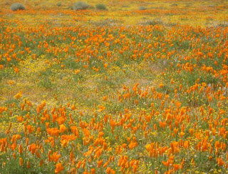
We had a nice Passover Seder at Lauren's uncle's house on Saturday night. On Sunday, her cousin and his family joined us for a nice trip out to the Antelope Valley to see the poppies and other wildflowers in full bloom.


We took the I -5 route and came into the valley from the west. There weren't many flowers above the foothills of Gorman but we did come across one patch that was worth stopping for to take some pictures. The poppies, of course, are beautiful by themselves, but they particularly stand out when they are surrounded by Lupines and other colorful flowers.

After Gorman we hopped on Rte 138 and headed toward the reserve. There were some large poppy fields at the base of the Tehachepis, but I wasn't sure if we could back to them so we didn't stop to explore. About 10 miles in we came across some spectacular fields right along the highway so we stopped for more pictures.

We had intentions of going to the reserve, but on the west side of Fairmont Butte the fields were just blanketed in flowers. Knowing the area from various hang gliding adventures I knew that there was a maze of dirt roads running through the fields; we spent the rest of our outing just driving along them.
Sunday, April 13, 2008

Marshall April 13th

The forecast was calling for 8-9k tops and light SE winds everywhere in Southern California from the L.A. Basin to the Central Valley so it seemed only logical to call a Crestline to Bakersfield goal. Sure we would have liked the tops in the desert higher, but what the hay, there is nothing wrong with aiming high -- get up above 10k above the Tahachepis and you practically have Bakersfield on a glide; the valley floor is only about 500ft. MSL.


Of course there was the little problem of the predicted morning NE winds. When the upslope switch occurred was key to how successful we would be. I met Bruce Barmakian at his house in San Bernardino at 8:00 just in case we decided that the winds wouldn't cooperate and we would head to Blackhawk instead.


The decision was made early to wait out the local winds. And wait out we did. Because of a persistent north we were unable to launch until just before 3:00. Fortunately, famed juggler Owen Morse was part of our crew; he promised that he could teach us how it was done in less than 20 minutes. So there we were, two truck loads of pilots atop of Marshall throwing rocks up in the air waiting for the winds to turn around. Surprisingly, no one got beaned; as a matter of fact, we all did pretty well -- although I don't think Owen has to worry about anyone taking food off of his table any time soon.


In our crew it was Bruce, RebarDan, Owen and me with Wally driving; we punched off together in that order as soon as our gliders were set up and ready to go. Owen and Bruce found something to left, and Dan and I to the right. After a slow start everything coalesced somewhere in the middle for a quick smooth climb to 9,000 ft (I'm the white track). Unfortunately, Owen missed the boat and was on the ground soon after. Apparently his fate was shared by about half the pilots on launch.

Ugh, more radio problems. I would have to chase the rigids around with the hope that they would see me following them OTB into the desert.

Another, not so smooth climb to the high 10s near Sugar Pine Mtn and it was "Game On," with Bruce leading the way -- at least I think it was Bruce; I lost track of the other rigid. Regardless, all three of us (four, if you count a very aggressive hawk) met up again just east of the Cajon Pass on the backside of the range.


Bruce bailed first in the mid 9s, followed by Dan soon after. I stayed back and was rewarded with another climb out to the mid 10s. I lost track of Bruce but I could see Dan taking a line along a ridge to the north of the valley that leads up toward Wrightwood from the 15. Because I left higher I was able to come in even with him as he was climbing out over the ridge. We didn't get terribly high but it was enough to keep moving on. But here I made a big strategical mistake: as Dan and I ran up the ridge together -- the Litespeed did a pretty good job of keeping up -- I found a slightly better line on the desert side of it. Because of that, and not having radio contact with Bruce to see how he was doing up ahead and where, I decided to go with it and angle out to the flats. Dan, and finding out later, Bruce, opted to stay in the mountains. Both were rewarded with eventual climb outs to 12k near the Mountain High ski area. I on the other hand was never able to get above 8300 ft for the rest of my flight.

Despite not getting terribly high I managed to make it to the Crystal Air sailport in pretty good shape. As I was coming in I could see a sailplane getting dropped off in a thermal to the north of my course line. I headed in his direction, but the lift proved to be fleeting. Both of us bailed at about the same time with the sailplane heading north and me west.


At just over 42 miles above the town of Pear Blossom, the old home of the USHGA, I ran into a headwind. Without contact with the other pilots because of my radio problems, and thinking that the seabreeze had pushed through (it hadn't; just some localized west wind I guess), I turned around thinking that I'd try an out and return. I didn't get far. And as you can see when I took a low leaner off the deck near the end of the flight it actually had a NE drift (didn't like where it was drifting me to so I threw in the towel and landed). At dark when I was eventually picked up, the seabreeze still hadn't come through so my decision to turn around was an obvious blunder. Live and don't learn - read how my previous flight ended.

Both of the rigids made it to west of Palmdale with Bruce taking the day with a 72 miler landing near the poppy reserve.


Tuesday, March 25, 2008

Easter Egg Hunt and Flight

We're a mixed religion family. We never go to church or temple, but we do recognize the holidays. Of course this past Sunday was Easter and what would the day be without an Easter egg hunt. The only problem was that the forecast was calling for a potentially good hang gliding day. So I did what any selfish father would do and scheduled the hunt for the crack of dawn so that I could be at launch at a reasonable time.


Despite having the hunt so early one of Bari's friends accepted our invitation to join her in the fun. Our dog Phoebe must like the scent of hard-boiled eggs, because she seemed to be in most of the pictures that were taken of the day.

Poor Nicholas, though, had some kind of bug and didn't get to sleep until about one a.m. and was still feeling it in the morning so he didn't participate until later in the day when he starting feeling better. And no, the remaining eggs weren't left outside all day waiting for him to find them.


Three hours after Bari had gathered her last egg I was set up and ready to go at the EJ Bowl launch in Santa Barbara. That's my usual flying partner's (Tony Deleo) VR in front of my Litespeed.

Originally we were thinking that Kagel might be the place to be. They were calling for light NE winds with thermal tops around 8k. Even though I live in L.A. I rarely fly Kagel so I'm no expert in reading the weather conditions for the place, but it looked to me like it could be one of those classic convergence days that I keep hearing about. A day to fly Crestline and beyond. But Saturday the forecast was calling for similar conditions and it ended up blowing down all day so we opted to head up to Santa Barbara instead.We were supposed to have record temps and the lapse rate looked great to about 6k, but because the mountains are so close to the ocean in SB you're never quite sure what you're going to get; the marine air has a habit of shutting things down in a hurry. Because of that we decided to start a little higher up on the range and launch from EJ Bowl rather than the Eliminator. Tony launched first and I was few minutes behind just after noon.

Both the RR and the Thermal Factory were working fine -- although, as you can see I had to search a bit before dialing into something above the latter.

Up ahead Tony seemed to be doing fine, but I didn't find anything at Montecito Peak itself and had to drop off to the east spine where I proceeded to drop below 3k hanging on to any scraps that would keep me in the ball game. Looking over to East Romero I could see that Tony was struggling too. After awhile both of us climbed out at about the same time despite the mile distance between us. It's funny how that works.
Romero wasn't that much different than Montecito, but I didn't have to hang around as long. Out front Tony was getting up at Castle Ridge so I left a little lower than I normally would (note the strong west drift at Romero). Didn't find anything on the spine that Tony was climbing out on so I continued on to the next one down the line where I found my strongest thermal since leaving launch which enabled me to get ahead of the Atos.


A few thermals later I had reached Noon Peak, the start of the Casitas Pass, comfortably. I climbed out right away to the mid 4s, but rather than take that altitude and continue on I decided to step back to the back of the range where I was hoping to find a convergence. Unfortunately, it didn't pan out and so I was forced to go back out front only to watch Tony climbed out above me to regain the lead. Feeling frustrated after not finding cohesive lift, I eventually ended up leaving for West Divide lower than my original climb out.

At Divide I never did reach the top of the peak (too impatient to hang tight -- although Divide is no place to be messing around waiting for something better to come through) so I ended up tempting fate again by coming in way low at Whiteledge. However, the 3 hour hike, sans glider, will have to wait for another day.

My normal go to spot after leaving Whiteledge wasn't working on this day, but I found something just west of Rte 33 that got me over to the Pyramid where I had on of the highest and smoothest climb out of the day. It was supposed to be in the 90s in Ojai so I had little doubt that that flying would be stellar once we reached the valley. I wasn't disappointed.

I usually stay out on the front points in Ojai, but because I had the altitude I decided to step back to the high ground at Chief's Peak; it wasn't worth it. I ended up having to angle back out front on my way to Boyd's. Normally Boyd's can be counted on to get you high enough for the glide to Santa Paula Peak but not on this day; nearby Puckers, however, was going off.

With light NE winds, the hope going into the day was to eke into Ojai from Santa Barbara and then work the NE/SW convergence to points east once we got to the Santa Clara river basin. Unfortunately, the sea breeze didn't over power the offshore stuff as far inland as we had hoped. Both Tony and I left the east side of Santa Paula Peak in the mid 7s with a west drift, but at 3:00 it was still blowing east at 15 mph in nearby Fillmore. In front of me, after getting tired of bucking a headwind, Tony opted to turn around at the 50 mile mark and land in Fillmore. Of course, I had to at least match that, but instead of turning around I tried to stretch out my flight as far as possible. I landed at the 50.64 mile mark. At 4 o'clock it was still blowing east in the LZ.

Tuesday, March 18, 2008

Mammoth

Took the family to Mammoth this past weekend. Despite the fact that it was snowy, cold and windy -- so much so that they had closed the top of the mountain for most of the two days that we were there -- and Nicholas spending most of Saturday layed up in the lodge with altitude sickness, everyone had a good time.

Technically, I'm not a bad skier -- in fact, I was an instructor at one time -- but when you ski as infrequently as I do (half dozen times in the last 25 years) proper technique only takes you so far. I simply don't have the leg strength to do well and enjoy myself on the bumps and steeps -- not that I did a lot of mogul skiing; it seems the snow boarders have eliminated most of the bumps fields from the slopes. But, this was family outing; I had more than enough fun spending time skiing with the kids.

Here we are in the middle of the Sierras during a beautiful snowy weekend and this is the view from our hotel room. I booked the reservation on line where they had a box designated for preferences. I put down that we didn't want a room next to the jacuzzi and that if possible wanted something with a view. When I called the hotel to confirm the reservation the guy at the desk said, "You requested something with a view?" "None of our rooms have views." No kidding. Other than that, though, everything else was fine.

After spending most of the day sleeping off the effects of altitude sickness on Saturday, Nicholas recovered enough to have a good time playing in the snow back at the hotel. It is amazing what a difference 2,000 ft can make. Right before leaving the hotel he was perfectly fine; twenty minutes later he was as white as a ghost. The same thing happened to him on a hang gliding trip to Walt's Point a few years ago. At launch he was fine. But after I had taken off, Lauren took the kids up to Horseshoe Meadows but had to immediately turn around because of Nicholas' sickness.

Speaking of the Owens Valley, here is a nice shot of Mount Tom. One of my goals is to fly from Walt's and meet Lauren and the kids in Mammoth. The flight is tough to accomplish because of the prevailing SW winds; and a preferable SE usually means overdevelopment. Anyway, if you want to have any chance of making it to Mammoth you must get over Coyote Flats (under clouds in the distance on the left) and get established over Mount Tom. One of these days.