Wednesday, September 17, 2014

Pine 9/14


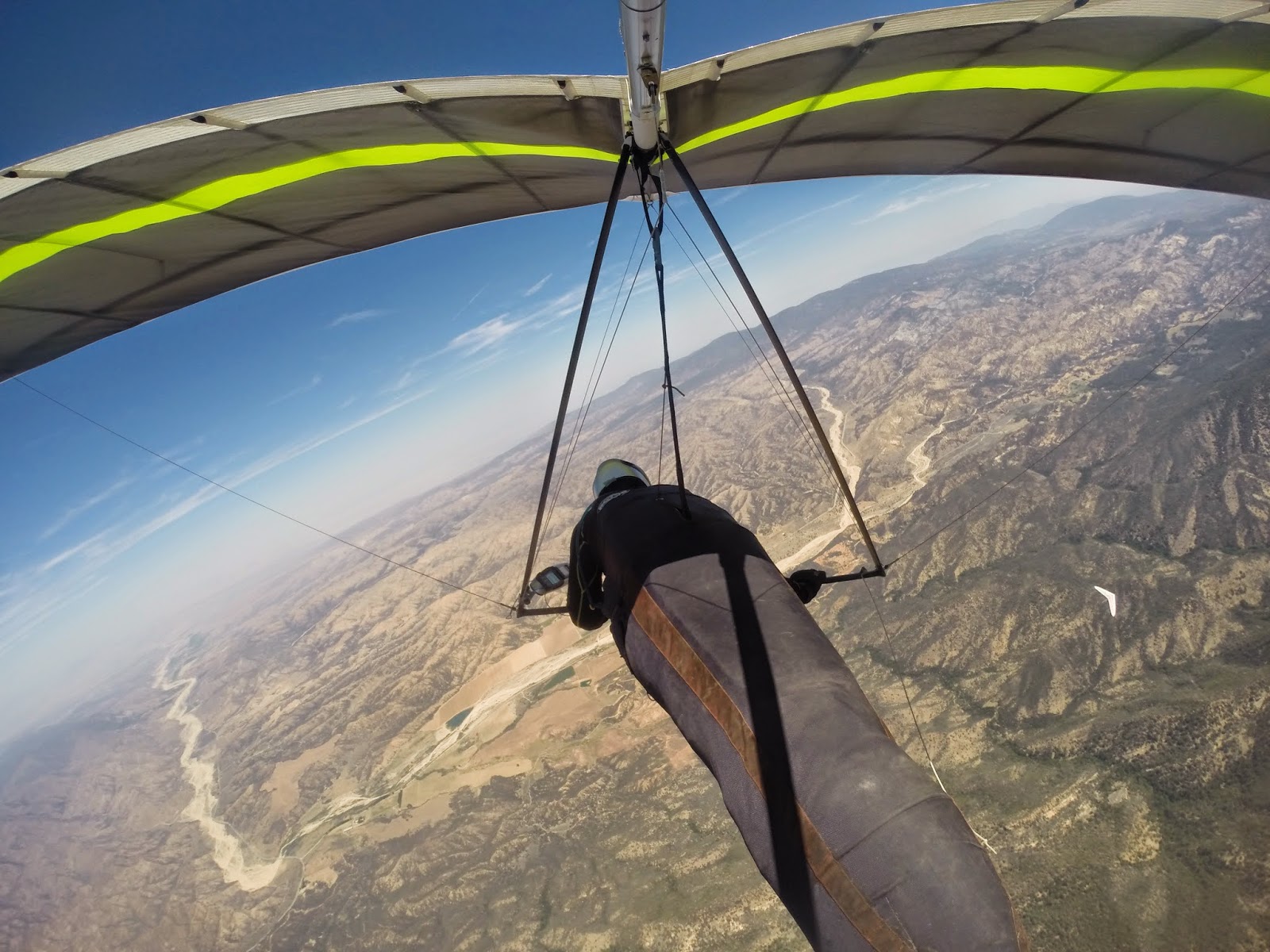
My LZs for my last two flights have been within 10 miles of each other. The only difference is that the second flight started 85 miles away. I didn’t do a write-up of my previous flight because there wasn’t much to write about. After 2 hours of bobbing up and down in front of Garlock I threw in the towel and landed right below launch. Sunday’s flight was a tad better.


We’ve had a heat wave here in Southern California over the last few days and the flying conditions have been just as toasty – everywhere. A few records have fallen. 

It’s not often that you see the tops on the front range match those in the desert. Because of that I was looking to fly either Kagel or Crestline, for no other reason than to defend my Marshall/Crestline out and return record. However, my Topa buddies had no interest in dealing with the LA traffic and were heading to Pine, and my Crestline mates were either in Santa Cruz, AZ or talking about doing an out and return out into the desert.  Since the heights were the same for the desert and the front range it made more sense to me to fly along the San Gabriels, considering the fact that the LA Basin floor is 3,000 ft. lower. I’m sure I could have convinced them to see it my way, but when the late Saturday night forecast didn’t quite match what I was seeing earlier, I opted for the safer call and joined the Topa crew at Pine.

Let me backtrack a bit here. As I mention, conditions looked good everywhere, and that included the Topatopa range in Ojai. It looked like it would be good enough to go OTB into the desert, a flight that only has been accomplished on a few occasions; once by yours truly. Unfortunately, you need a permit to fly Ojai and it’s hunting season; there was not one left to be had. However, the PGers have a hike-up launch known as the Nuthouse. Three intrepid souls opted to brave the 107 degree heat and go there, including Tom Truax who would go on to fly 111 miles, breaking the site record.


Although the forecast looked great the tops weren’t expected to be terribly high. Somewhere in the 12-13k range. Also, the winds at Pine had a bit more south than what you would like for a flight out into the desert. One of the reasons the PGs opted for Ojai instead. One thing that I didn’t see in the forecast was a call for mid to high level clouds. There was a slug of it right above launch when we arrived. There also a few lennys mixed in for good measure.  Our optimism took a bit of a hit to say the least. But, despite the high cloud cover, cumis began forming above launch just after 11:00. Not too long after that pilots began throwing off.  There were 6 in total, two in each crew. Tony Deleo was gracious enough to drive for TQ and me.

Launch

Despite the great forecast, no one was screaming to cloudbase. John Hesch and I had the same idea to search more out front, but that ended up not working any better than what was happening above the ridge. Eventually, though, everyone got up and out. Whereas the other pilots opted to go straight over the back I decided to give Reyes a try, with the idea of staying on the front side of Pine to perhaps Decision Point before going OTB. At Reyes I made a mistake that almost cost me the flight. Not getting very high on my first climb out, I decided to take what I had and head for the Chute rather than stick around for a better thermal or continue east to Haddock. I did this despite that fact there were no clouds above the Chute, compared to everywhere else (probably because of the south wind). Sure enough, I didn’t find anything above the Chute and had to bail off low toward Dry Canyon.


Reyes

There’s a nice green valley between the Chute and the ridgeline just south the Dry Canyon. I didn’t realize, though, that the landable areas of the valley sit up on a plateau. The original idea was to work the ridge to as low as I needed to go before bailing out to land. The plateau gave me little room to spare. Down below 5k I had little choice but to give up the ridge and head back to the valley. Luckily, I blundered into something right above a ranch that got me back to 9k. Plenty high to be back in the ball game but not high enough to make the jump to Lockwood, especially in a south wind. TQ had already made the jump at that point.


Climbing out of a hole

It took a while, but I eventually found something to take me into Lockwood. TQ had reported earlier that he had found something above Boy Scout road. It was still there. I was soon close to my highest point of the day making my way to Frazier, albeit along a course line a little further north than what I would have liked given the wind direction.  


On my way to Frazier

But a little skip on the east side of Lockwood gave me enough altitude to get above Frazier comfortably. Up in front of me, though, a small fire had broken out on the NE side of the mountain. I had the altitude to fly over the air traffic dealing with the fire, but I ended up leaving Frazier lower than what I had hoped in order to clear the area has fast as I could. 


Heading out into the desert

I ended up crossing the 5 with just over 9k. My glide was on the wrong side of the cloud street, but I didn’t want to give up my precious altitude fudging more south. I had my sights set on a little foothill peak sitting in the sun right behind the cement plant, and at that point it looked like I had just enough altitude to make it. Somewhere on my glide I passed TQ, although I never saw him. He would end up landing nearby.


The Antelope Valley

I did reach the peak, but it was only good for enough altitude to continue on. Despite the clouds forming above the Tehachapis the range is a bit shallow in this area; I didn’t feel comfortable diving back to them low so I took a more southerly angle. After a series of skips, I lucked into the best thermal of the day, having the pleasure of sharing it with a redtail hawk. The lift would have taken me to cloudbase, but still being a bit wary, I opted to dive out well short of it. Still, I was close to 12k which was plenty high to step back to the ridgeline.

By this point I was the only hang glider pilot flying in the Antelope Valley. TQ had landed just north of Neenatch, and two of the other pilots landed near the 5, while the other two opted to fly north, with one flying 45 miles into the Central Valley. I was the only hang glider on the Tehachipis, but up in front of me was Tom Truax on his paraglider. He indeed made the connection into the desert from Ojai. Although I never saw him I think I passed him around the 60 mile mark, right about the time that my motion sickness kicked in. 

If you’ve read this blog before you know the routine: once I get sick I have about a 20 minute window before the second bout kicks in; if I can get on the ground before that, I’m pretty much OK. But if I have a second bout then I’m a mess for at least 2 hours after that even though I’m on the ground. So the idea is to fly as far as I can in that 20 minute window. I’m not sure how high I got in thermal when I first got sick, but I do know that I reported on the radio that I was at 7100 ft at 71 miles out. One more climb and I’d have enough altitude for my 100 miler. Soon after the radio report I hit some lift. I told myself that I was going to stay with it as long as I could despite feeling the way that I did. Unfortunately, I kept on falling out of it, and frankly, I just didn’t have the mental fortitude to stay with it. Soon after that I was on the ground.


Distance: 85.5 Miles
Duration: 3:45 hours
Max Altitude: 11,948 ft.

Monday, June 9, 2014

Pine Mountain 6/8

Nice rewarding flight from Pine yesterday despite not making goal. With an east wind we were hoping for an out and return to perhaps the cement plant near Quail Lake in the Antelope Valley, but ended up turning around at the airport on the east side of Lockwood Valley.


Just TQ an old flying friend and I were up there yesterday. Both of us in need of shaking off some rust. Driving up to launch we were a bit concerned about the wind direction as there was a pretty good north breeze all the way up to the drive up north launch. However, it was coming in nicely at the south launch when we arrived. We launched one right after the other around noon. 


Launch

It took a little while to find the ticket above the ridge line, but once there things opened up. 
Soon after I was making my way against an 8mph headwind to the Chute from about 13k. Being a bit lower Todd opted to fudge back toward launch in search of a better climb.

Climbing out with TQ behind launch

The Chute was bouyant but I seemed to lose everything I tried to turn in before completing my 360s. But I had plenty of altitude to play with so I just kept on plugging up wind along the ridge line. At about the same time that TQ announced on the radio that a cumi was forming over the ridge my vario started screaming...and didn't stop until I was just north of 14k. 


East bound from the Chute at 14k

From the east end of the Chute I worked a seam between Guillermo and Grade Valley. Once near Guilermo I angled toward it. But like the west end of the Chute the air above it was buoyant but I was unable to find something to core. Rather than stopping to search I just kept plugging forward along the foothills just south of Lockwood. The problem was the lower I got the stronger the headwind as the east was funneling through the gap between Frazier and Alamo Mountain. Below 9k just short of Frazier, I was flying against a 15mph headwind. Staying along the same line didn't seem very prudent so opted to veer north into Lockwood. 


East end of Lockwood Valley

Of course when your in the middle of the valley you just hope you might flounder into something. I never did until saw a crow start to turn circles near the airport. I headed in his direction and was rewarded with the strongest (and smoothest) thermal I've been in in long time. And then just like that it was gone. Here I was thinking that I'd get another chance at Frazier, but instead I was running downwind in the other direction back in flounder mode. I was down to about 6300 ft before picking up some scraps above Boy Scout Road. At about the same time TQ was reporting that he just gotten to Guillermo with 12k. To the west of us running north to south from the middle of Dry Canyon to the middle of the Chute a cloud street had set up along the East/West convergence line. 


Convergence line out in the distance


I just needed to get up at the end of Boy Scout and we both could B-line it to the street and then just bridge it out to Ojai. And get up I did. Once I drifted over the foothills on the west end of Lockwood everything opened up. Soon I was back to 14k flying down wind to the cloud street. TQ took a slightly different line that didn't work quite as well, but he had no problem making it to the convergence line.


To make my flight more of a triangle I opted to head to the cloud that was farthest to the north. It was about halfway up Dry Canyon. I found something nearby that got me close to base and then after that I headed due south along the convergence line. Again the air was buoyant but I never really found something to stop for. I turned some half ass circles above the Chute below a cloud, but at 12,500 ft I already had plenty altitude to make it out to Ojai. And that's what I did. As did TQ not much longer after me.

Distance: 47.5 Miles
Max Altitude: 14,350
Duration: 3 Hours


Wednesday, January 15, 2014

Santa Barbara 1/5

You can grow old waiting for the perfect day. Especially when that day has to fall on a weekend. Since this is January this is Santa Barbara season for me. Sure, you can't beat cloudbase at 17, 000 ft. over some god-forsaken place in the summer, but flying down range in Santa Barbara will always be where it is at for me. There is nothing like getting in close to the terrain and putting the glider on its ear while you watch the ground fall away. And if I have to say so myself, it is a type of flying that I'm pretty good at. But the problem with Santa Barbara is its proximity to the coast. It can be soarable throughout the year, but it is at its best during post-frontal days when the temperature gradient between the ocean and land is fairly neutral. Unfortunately, last year was the driest year ever recorded. And so far this year has been just a series of Santa Ana days. But, if Santa Barbara is at its finest during  post-frontal days, the second best conditions are during Santa Ana winds. The NE winds are generally blocked by the orientation of the mountain range. But because the general flow is off-shore the marine air is kept at bay. The problem with Santa Ana days is that the XC potential is limited. The strong off-shore stuff usually kicks in between the 30-40 mile mark.

Ever since I decided to come back after my deployment flight I've been looking for one of those perfect days. A day that would really get my juices flowing again. Up to this point I've had four flights; none of which would qualify. But like I said, you can grow old waiting for the perfect day. Sunday the forecast called for Santa Ana conditions, the wife and kids would be on their way to Palo Alto, and an old friend that had been away from the sport would be making an appearance. I decided that it would at least be a good day to shake off some rust.

I met Tom Truax and Todd Quayle at Tom's house in Carpenteria. Since we weren't flying open distance the day took on a more social tone. Tom's wife Pam and TQ's friend Robin decided to join us and act as drivers. Later we would have a nice late lunch and reminisce about the old Topa Flyer days.

The forecast was calling for a better lapse rate above 3k, so we decided to head up to the higher EJ Bowl rather than the normal Eliminator (Skyport) launch. Despite being more exposed to north winds it was blowing up nicely when we arrived sometime around 11:00. The HG launch is off a turnoff in the road, whereas the PGs take off from a knob just above it on the range. TQ and I were dropped off as Tom was driven up to the hike in point for the PG launch. Later Pam would report that there must have been thirty PG pilots waiting their turn to take off.


About half-way through set up the PGs starting taking off with various forms of success. The first pilot off would end up flushing. But, soon after that pilots began sticking just above the spine to the right of take off. Save for one or two pilots, however, none stayed long. One by one they had to head out to the RR where they could be seen yo-yoing above and below the peak. One pilot that managed to hang on was Tom. He was still out front when I launched sometime before noon.

I have probably taken off from this launch a dozen or so times over the years and I don’t believe I have ever climbed out above it. Sunday was no exception. I made a half-ass attempt right below where Tom was, but like most of the PGs I soon found myself limping out to the RR. It should be noted here that I was still well above the Eliminator and so I was nowhere near in danger of landing at that point.

With the number of PGs reported to be at launch, I was worried about death gaggles in front of the RR. I’m not sure where they all went, but I only had to share my rather nice thermal with 3 or 4 of them as I climbed out above the peak. And at no point did I have to go wing tip to wing tip with any of them. But just to be on the safe side as soon as I had the altitude to head west I took it, with the idea of using the VOR as a turn point.


Since the RR worked so well, I just assumed it was going to be a paint-by-the-numbers day: Cathedral, West Bowl, No Name, VOR and then back again. Only, Cathedral didn’t work and I soon found myself flailing away below Tunnel Tit, which sits below the RR. Not finding anything to latch on to I had to fall off even further to the Holy Hills. While this was all happening, Tom transmitted on the radio that he was climbing through 5k over La Cumbre Peak, about twice as high as I was at that point.

But this is what is so great about flying the mountains: you usually get more than one chance to stay in the ball game. Even if I didn’t get up at the Holy Hills, there were still a couple of more option further out front. But as it turned out I didn’t need them. The Holy Hills were breathing rather nicely and I soon found myself climbing out with my old friend TQ. It has been a long time since I a shared a thermal with TQ; it made the climb extra sweet. Having said that, I’m not sure you could say that we were all that in tuned with each other. Because of that I left early and headed back over to the RR. TQ on the other hand decided to head east to the Thermal Factory.


My first go at the RR didn’t work and so I had to limp back to the Holy Hills for a re-boost.  This time I got a bit higher and soon after that I was climbing out over the RR, higher than the very first time just after launch. The goal was still an out and return to the VOR. I had the altitude now to make a play for La Cumbre Peak. When I arrived Tom was still playing in the air there. But where he was above the peak I was a tad below…and struggling. Soon after that I found myself above Cathedral again. This time I was bit higher, but still not able to dial into anything. But rather than limp back toward the east I decided to take what I had and head west to West Bowl.

I don’t know if it was just rust or the conditions, but other than at the RR and the Holy Hills I had a hard time coring the thermals. West Bowl was no exception. But after about 20 minutes of trying I finally got high enough to continue my trek west to No Name. There I came in below John Greynald on an Atos working is way back from the VOR. Robert Millington had made the tag a bit earlier; the last time that I saw him he was making his way back from the Alternator.


No Name was good for a skip to get over to the VOR comfortably where I shared a thermal with a PG that had used it as a take off spot. Tom had already made the turnaround before I arrived. As far as I could tell no other PGs flew west of La Cumbre.


I didn’t manage to get very high at the VOR but it was enough to head back. I think I left with 3k. I came in a bit low at No Name, but I ended up finding one of the better thermals of the day. Soon I was back over at West Bowl. It seemed like the day was opening up a bit, but I couldn’t find anything worth stopping for. Rather than fish around I decided to take what I had and eke over to Cathedral. Luckily, I found the best lift of the day. Good enough to get Tom to leave his thermal directly above Cathedral and head in my direction. Soon after that, both of us were on our way back to the RR. On the way over I declared that I was going to tag the Thermal Factory and then head out to the beach.


I didn’t notice it so much in the mountains, but on my glide to the beach I ran into a significant east wind. It really was a struggle to fly straight. Even though I left above the Thermal Factory there was a point there where I wasn’t sure I’d make it. But as it turned out the lower level stuff was out of the SW and I ended up needing to burn off altitude near the 101 in order not to breach the restricted airspace. Tom, however, would come up short and was forced to land on the railroad tracks. TQ was already at the beach when I arrived, opting to stay closer to launch during his flight. Overall a nice 2 hour jaunt.   

Wednesday, November 6, 2013

Catching up

I thought it was time to catch up.

I guess I should write something first about my deployment flight. It was never the case that I didn't want to revisit it, it’s just that I never got around to writing up a flight report. If you've seen the video and read my intro I state that I didn’t want to indulge in excuse making for the decisions I made leading up to the deployment. I guess what I’m about to write here reneges on that promise a bit.

I actually chose to fly on Sunday rather than Saturday, because the forecast called for less moisture. Both the top of the lift and cloudbase were pegged to be close to 14k. But nowhere was there any indication of overdevelopment. And, really, there wasn’t any. By the time I got up and out from launch there were a few clouds on the backside of Pine and some development over Lockwood Valley and Frazier. But other than that there were blue skies everywhere.

I think I left Reyes Peak somewhere near 12k for my glide over the “Badlands.”  If I remember correctly, I came into Grade Valley comfortably without having to stop for a boost along the way.


Updated video of the flight from start to finish


Although the skies were dark above the eastern side of Lockwood and Frazier there wasn’t any towering development. Frazier’s “whaleback” ridge runs SW to NE; most of the major development ran from the south side of Lockwood right over the ridgeline. There was, however, a line of clouds that joined the main development from the south. As I began to work lift just on the east side of Grade Valley, right below the western terminus of the cloud street running over Frazier, that other street was just a line of individual clouds. Beyond that there wasn’t another cloud in the sky for twenty miles.

It wasn’t long after reaching Grade that I was turning circles near 14k and cloudbase. I purposely stayed below the southern edge of the cloudstreet to give myself an out. Despite that, I still had to dive away from wispies on my glide to the SE; my glide angle putting me a couple of miles south of Frazier and away from the main development. I just had to scoot under the clouds running in from the south and I’d be in a great position for my glide out into the desert, where as mentioned, the next cloud was twenty miles away.

The southern cloud street had filled in from when I first arrived at Lockwood. Despite that, from my angle near base, the cloud line didn’t look very wide. The shadows on the ground should have been a tell, but at the time I thought most of the darkness was caused by the stuff billowing up above Frazier. The fact that there was nothing but blue skies on the other side of the clouds was probably the main factor for me continuing on. That, and the fact that I’ve seen these conditions before near Frazier, and made it through to the other side without issue.

As I left the lift near Grade to go on my glide I thought I was in perfect position. By the time that I would reach the last line of clouds I would lose enough altitude to scoot underneath them. If I did encounter any lift I would already be close enough to the other side to avoid any trouble. Of course, that didn’t happen; if anything I gained altitude.

From the video it looks like I flew right into the clouds. But it didn’t quite happen that way. On the way to the cloud line my focus was on its dark edge. I hadn’t actually reached it when I became engulfed in white. It all happened rather quickly. Of course in hindsight I should have whipped the glider around to head back from where I came. However, my first instinct was to try to fly fast and straight and to keep the wings level. As I mention above, the cloud line didn’t seem all that wide, and so I really thought that I’d pop out the other side rather quickly.

It should be noted here that this was not a cu-nim. Cloud base was 14k, but the tops, even above Frazier, were no more than 17k.

Once in the cloud conditions became very turbulent. To avoid PIO I popped the VG (after a few tries) and slowed the glider down. It doesn’t show it in the video, but at one point the control bar was almost ripped from my hands. Soon after that I no longer had control of the glider. Thinking about it, more than likely I was in a spiral dive. Regardless, I no longer had command of the situation; to take it back, I decided to throw my reserve.

Perhaps I should have let things play out. After all, one way we are told to escape cloud suck is to put the glider in a spiral dive. But bad things can happen from a spiral dive, especially when you’re not in control. Not long before this I watched an aerobatic pilot die after a stall during an attempted loop when his wings folded up around him, which made it impossible to get out his reserve. Thinking about my kids, I wasn’t going to take the chance of something like that happening so I threw the reserve. I think, violent, would best describe the situation after the chute inflated. The pull with just one hand on the base tube was enough to destroy the control bar.

The video cuts off soon after inflation, but you do get a glimpse of how I was tossed about. That went on until finally clearing the clouds on my descent. With SW winds I had hoped that my drift would take me to Hungary Valley and civilization. If anything, I headed west instead. I think the position of my still intact wings had something to do with that. 

During the ride down I managed to unzip my harness to get my legs out for impact. After doing so, I climbed over to the top side of the glider to avoid getting entangled in the wires and metal of the broken control bar. I came down on a ridgeline just south of Frazier. I did what I could to land on my feet, but the canopy draped over a tree twisting my body so that I hit the ground with my shoulder. Luckily, having the canopy catch the tree minimized the impact. Besides a gash along the back of my neck – one that I didn’t notice until it was pointed out later – I walked away unharmed.  

After thinking, “well, I survived” as I sat there on the ground, the second thought that came into my mind was that it was probably a good time to give the sport up. Not because I was worrying about my own well being – I’ve been well aware of the risk since leaving the training hill back in 1984 – but being a husband and father, of course, made it more than just about me. I guess one could argue that, no, it has always been about me, because a responsible father wouldn’t assume that risk in the first place. Frankly, I don’t really have an answer to that, other than to admit that it has been and is selfish of me to fly.


A little help from my friends, Dan DeWeese and Owen Morse. That's Dan up in the tree. The reserve made it though the ordeal intact.

I used to fly every weekend. But the agreement I made with my wife curtailed my flying to once a month once our first child was born in 1996. However, for the last few years leading up to here, the time between flights seemed to get longer and longer. Some of that had to do with the internet and modern weather forecasting. If I was only going to fly on occasion, it would only be on a good day. These tools made it easy to stay home on marginal days. But leading up to the flight I found myself looking for reasons not to fly rather than the opposite. Quite frankly, hang gliding just wasn’t doing it for me anymore. This flight was only my third in the previous 365 plus days.

Looking at the glider on the ground it was obvious that the repairs would be costly. Besides my family situation, I didn’t think whatever interest I had left in the sport was enough to justify paying the expenses needed to get back into the air. I decided right there and then to call it a day.

But a month or so later I was sitting on a picnic bench at my In-Laws’ property near Santa Cruz when I noticed a redtail take flight from a nearby tree. As he turned lazy circles above me I thought, “I used to do that,” “Maybe I want to again.” As the hawk climbed out above me I decided I would at least go ahead with the repairs, which included a need for a new sail. If when finished I still didn’t want to fly anymore I could always sell my equipment with a minimal loss.

After the repairs were done the glider just sat in the garage. Every time that I thought I wanted to get back into the sport I would think of all the hassles involved, from securing drivers to long days in the desert to my airsickness problem. But, I wanted to at least fly one more time before making a final decision. That day came two Februarys ago in Santa Barbara. Unfortunately, it ended up being a marginal day. After turning circles over the same spot for an hour I flew out to the beach with the same feeling I had going into the flight. The glider went back to its same resting spot in the garage. Then that summer my flying partner and best friend had a near fatal accident. A funny thing, though: as he lay in the hospital during his long recovery, I actually felt an obligation to fly again for his sake, rather than looking at the accident as the final nail. Despite that, the glider didn’t budge from the garage.

That was until last January in Santa Barbara.


Cloud cover made the day a carbon copy of my last flight, but with one major exception: I felt excited about flying again. Of course, that didn’t get me back in the air again until June. 

My attitude after the January flight was that if things looked good and it was convenient I’d fly.  One place that is never convenient is Blackhawk. It’s over 3 hours to launch and I’m usually flying away from home. It’s a leave home early get home late place, and more often than not, triple digit temperatures on the ground. But my two longest flights have been from Blackhawk and conditions looked good and we had a driver and so I decided to go out there again. 

Light and variable conditions made launching a bit sketchy. It’s a good thing I still have some umph left in my 55 year-old legs because it took an awful long run to get airborne. Blackhawk is a funny place: it probably has more 100+ mile flights than any other site in Southern California; despite that, getting up at launch takes work and is never a sure thing. Because of that, it tasted extra sweet to climb out soon after launching. The forecast was for 12k cloud base. I left launch on my way east with 10k.

After a long glide and some struggle in a bit of ratty lift, I managed to dial into something that got me to 12k and cloudbase. Besides just getting back in the ball game, it felt good working the lift. It wasn’t straight forward as the core would change directions on the way to base, forcing me to make adjustments along the way.


Photo by Jonathan Dietch

I would work one more thermal before a long glide to the deck, with thoughts of my deployment flight the main reason for landing early. Ahead of my course line sat a fairly wide dark bottomed cloud. At the time I was probably 2,000 ft below it. As I flew under the cloud I told myself that if I found lift close to the other side I’d work it, but if I found it on the near side I’d fly though it without stopping. The lift was on the near side. The extra 1,500 ft or so would have gotten me above Copper Mountain, which in the past has proven to be a pretty reliable thermal generator. I ended up landing at its base. The flight was just under 40 miles, but it was rewarding in its own way.

Despite feeling good about flying again, I didn’t get airborne again until just a couple of weeks ago. I made an attempt to fly Crestline in September, but for the first time in my flying career, despite my motion sickness problem, I felt nauseated at launch. We had hoped to go over the back for a long flight into the desert, but overdevelopment put a stop to that. So as it turned out I didn’t miss much anyway.

Two weeks ago I flew Oat Mountain above Fillmore. Because it is part of the Sant Clara river basin Oat generally is not the best place to fly. It's only about 15 miles or so from the coast and under normal conditions the sea breeze funnels right through the basin. We were actually supposed to fly Ojai, but idiot me didn't remember to call for a permit until 4:44; the ranger station closes at 4:30. However, the forecast was calling for SE winds, which would keep the marine air at bay. The lapse rate between 3 and 9k gave us hope that we might be able to get up high enough to connect into Ojai and eventually to Santa Barbara, a flight that has never been done before. However, the surface temperature never got close to what was predicted. And as you can see in the video we didn’t get very far.


If there is one aspect of this sport that is not "just like riding a bike" it would be landing. The more time that passes between flights the more apprehensive I've become about it. Anyway, the flight wasn't what I was hoping for, but I felt good about the landing. It gave me a bit of a boost in confidence to go forward.

Now I do believe we're done caught up.


Monday, May 16, 2011

Bates to East Ventura

Two years ago at this time we were getting to 15k in the desert, flying north of 100 miles, the Santa Barbara season a distant memory. But here it is the middle of May and weatherman is calling for 5,000 ft snow levels. A post-frontal day in Santa Barbara? Unfortunately, a bit too much moisture and winds in the wrong direction kept us out of mountains, but Bates was there as a fall back.


From the Avenue I was hoping to bridge over to the Santa Susana mountains for points east. There were some wispies above the foothills but once I left I found nothing but turbulent sink. In the past I've left the Avenue lower and have gotten out on the Oxnard Plain further.

And then, of course, there's the landing. It was pretty rowdy, but it didn't help that when going for the down tube my hand got caught on my rear wire. I tried to fly it in holding on to the wire, but as you see I wasn't very successful.

Thursday, March 3, 2011

Santa Barbara Presidents' Day


Well, I said that I usually don't do a lot of flying during the fall months. The problem with trying to pick the good days is that they don't always correspond with your schedule. You don't want to waste a kitchen pass on an average day for fear the following weekend will turn epic. So you keep waiting. Only, the next thing you know five months have gone by.

Anyway, after what seemed like weeks of offshore winds we finally saw a change in the weather pattern. The offshore stuff had given way to a series of cold fronts. Just what you like to see when flying in Santa Barbra. Earlier in the week Robert Millington had flown out to the interstate (60+ miles)in about two and a half hours in classic post-frontal conditions. The forecast called for another storm to come through Saturday afternoon to early Sunday morning, leaving Sunday afternoon and Presidents' Day post-frontal. We were to celebrate my son's birthday at the paintball park on Sunday so Monday was my day to fly.

As I've mentioned in the past the problem with post-frontal days in Santa Barbara is that often times the winds can be too strong over the back and or cloud base too low for a great flight. On Sunday the winds were OTB for most of the day. And looking at the forecast it looked like cloud base might be an issue for Monday. But the lapse rate look good to about 6k and the winds light SW. I talked Owen Morse into joining me for the trek up. Tony Deleo graciously volunteered to drive for us. We would pick up Tom Truax along the way.

Well, cloud base ended up being an issue. It was a fun short flight, albeit an expensive one.


Owen hadn't flown XC toward the east before so I played tour guide. I got up to cloud base (3500ft) above the Thermal Factory and then flew out to the Antenna Farm where Owen was getting established. Cloud base was low, but the lift was pretty much everywhere. Because of the low base, I had to take a line to Shadow Peak before making my way over to Montecito.


Back at the Antenna Farm I assumed that Owen saw me go on glide and followed behind. However, that wasn't the case so I hung out on the east spine of Montecito waiting for him to catch up.


Another quick climb to cloud base at East Romero and then off to the east with Owen in tow.


Back at launch it looked like base was high enough east of Romero to at least give the Casitas Pass a shot; by the time we got to the area things had filled in, however. East of Castle Ridge I had hoped to skirt along the bottom of the clouds, but the lift was just too prevalent and so I had to bail off to the SE to avoid getting whited out. Owen was still back a bit so I got on the radio to say that I was forced off of the range and that he might want to consider turning around. However, right after that, Tom, who had launched before us, transmitted that he had climbed to 7200 ft up the face of the clouds just behind Cate school. That prompted everyone to head out to the front points, including Robert Millington and John Hesch who were just behind us on the range.


After getting back to base at Snowball I pushed along the front points east hoping to find the same lift as Tom. Barring that the idea was to work my way up Laguna Ridge, which was still below base. I'd get to cloud base there and then peek over the side to see what kind of glide I would need in order to get to the fields north of Lake Casitas. Unfortunately, I didn't find lift at the base of Laguna so I decided to go for and out and return instead. But I got stuck in a hole, along with Owen and John Hesch (Robert turned around at Snowball), and never got high enough to get back on course. Owen and John landed in the big field just south of the yellow portion of the track log. The LZ was someone's personal polo ground. I wasn't sure how we would be received so I opted for Cate school instead. It turned out that those guys were more welcomed than I was.

Cate School. The tracklog is cut off a bit. I landed in right center field, only this isn't an updated image. The school has added new landscaping. See Below for my crude rendering:


I indicated earlier that it was a fun but expensive flight. I took out two downtubes and a corner bracket dodging the newly added trees.

Time: 1:18
Distance: 14 Miles
Max Alt: 3,600 ft.

Tom would end up landing in Fillmore. Let's just say that he didn't actually climb up the face of the cloud when he reached 7200 ft.

Tuesday, September 28, 2010

Marshall Out and Return

A view of LA from Mt. Wilson

I'm still around. I haven't posted because I haven't had anything to write about. All the family and personal stuff is now on Facebook, and as far as the flying stories, well, like I just said, there hasn't been anything to write about. It's been a terrible year since my last entry. Four out of my ten flights ended up on the deck in front launch -- I think that the last time that I flushed right from launch was back in 2001. On two other occasions I landed early while the other pilots I was flying with ended up setting site distance records. And even though the remaining flights were okay they all ended in disappointment for one reason or other.

Despite the fact that I only fly about 10 to 12 times a year each year I try to make it my goal to break some sort of personal record, whether it be my longest flight in general or a first from a particular site. During the first half of last year I had several personal bests, but with the end of summer here it was beginning to look like this would be the first year in a long time where it didn't happen. Generally, I don't do a lot of flying between the end of summer and the first of the year when Santa Barbara begins to turn on (well, potentially turns on).

During a normal year, August and early September is the time when we see "Four Corners" highs set up, which bring in SE winds and sub-tropical moisture. Here in So Cal SE winds are desirable because they keep the marine air at bay -- no marine air no inversion layers. And other than during the spring rainy season most of the flying done here is under blue skies so a little moisture is always welcomed, with the operable word being "little." Often times it will OD due to too much moisture. Still, it's always a good idea to clear the calendar when the weatherman starts talking about Four Corner highs. But so far this year we've only seen one brief 1 or 2 day period where the high has set up, and with October around the corner it just didn't seem we'd get another chance at a long flight. But, just when you think the best of the flying season is over...

...Along comes a pretty good weather forecast. If late summer means a chance of sub-tropical moisture, fall means the chance of offshore Santa Ana winds. The Friday through Monday forecast was for hot temperatures and offshore winds. But with no upper level support the winds were supposed to be relatively light, allowing the possibility of flying the front range from either Kagel or Crestline. Light offshore winds can be conducive to excellent flying, because if you can get off the hill you have good chance of finding a convergence if and when the seabreeze comes in. Now having said that, this four day forecast showed only the winds above 6k as being offshore. Below 6k, depending on the model, the early afternoon winds were predicted to be either SW, south or SE. Other than RUC, which was showing SE winds all day, the models had a light due west wind push through by the end of the day. That it is, below 6k. Above 6k it was supposed to be east all day.

Despite the lower level winds not being offshore there was no prediction of an inversion layer, which is exactly what you hope for when flying the front range. No inversion layer usually equals high climbs. And sure enough, the predicted tops for the four day forecast straddled 10,000 feet (14k for Monday). Since my son had a football game on Saturday, Sunday was my day to fly.

As I watched the forecast leading up to Sunday the only inconsistency was the amount of north and south influence in the upper winds and just when or if the west was supposed to push through. On some runs the call was for it to be SE throughout boundary layer all day (on Sunday that is what RUC was still calling for) so the thought was a possible flight to the beach from Crestline. But as we got closer to Sunday the upper level NE presented itself consistently with each model run along with the late afternoon west push. We'd have to see how things panned out once we got in the air, but an out and return flight to the west seemed the better call.

Our crew consisted of Jonathan Dietch, Scott Smith, Peter Debillis(sp?)and me. Bruce Barmakian was fighting a cold and graciously volunteered to drive for us. We were to meet Dan DeWeese at the Crestline launch. One person that was missing that I had hoped would be there was Owen Morse. Since Owen owns the both the open distance and out and return records it would be only fair that he'd be there to defend them. Besides, Owen is one of my flying buddies.

Dealing with dust devils. Photo by Jonathan Dietch

The morning flow was out of the north so the decision was to head to Marshall instead of Crestline. Dan opted to wait out the winds at Crestline. The winds were south at the LZ when we left at about 10:30, but it was blowing down at Marshall when we arrived. It wasn't until just before 1:00 when the first switch indicating dust devil presented itself. A few more would show up with one flipping over Chris Van Veldon's glider (no harm) within an inch of mine. While most of us were dodging the dust devils Jonathan decided to launch to take advantage of the convergence. Other than an hairy moment before he had a chance to walk his glider down to launch it ended up panning out for him. Soon after take off he was high enough to take a glide to the back ridge. It wasn't until about 1:30 when the rest of us worked our way down to take-off with Scott leading the way. An earlier launching PG struggled to hook into something in front of us and had to bail off to the west. But that wasn't the case for Scott and I. Soon after getting airborne, both of us quickly made our way to 9k+. Looking out to the west I noticed that PG had skyed out too. It was obvious the line to take was due west rather than to step back to the higher ground.


However, I spent more time concentrating on my radio than what line to take. Dummy me walked out of the house with out a radio. Luckily Jonathan had one to spare. Unfortunately, somehow during my initial climb both my headset and PTT connections came undone. Anyone watching my glide must have wondered what the heck I was doing as I was flying with one and sometimes no hands trying to get the plugs reconnected. Talk about PIO.

After burning off more altitude than I should have I had to decide whether or not to continue on to the San Gabriels or search around for one more boost. I was out in front of Pine Mountain at the time. With Scott in tow I opted to continue on. In the middle of the Cajon Pass I stopped to work a little pop. It didn't seem like it was going to take me anywhere so I blew it off and continued my trek west. As I continued on I looked back to see what Scott was doing and to my chagrin he was climbing out in the thermal that I had just passed up. Oh well.


Down to just under 5k I found some light lift just west of Lytle Creek on the foothills of the San Gabriels. The core was a bit elusive but the air was pretty smooth. Scott had joined me after a few hundred foot gain and having another pilot there helped in finding the thermal's sweetspot. There's nothing more pleasurable than when a thermal opens up as you reach altitude. The lift gets stronger but the air becomes smoother. This particular thermal was perfect example. It was so smooth in fact, that by the time I topped out somewhere over 11k, I finally was able to get my radio wires sorted out. Well, at least to where I could hear people; for some reason the PTT wouldn't work.

Scott was having radio issues too. His PTT wasn't working from the beginning so the idea was for us to stay close together. But once I topped out and went on my glide to the west end of Cucamunga Peak I never saw him again. At the western side of Cucamunga I had to fall off the main spine after not finding anything over the high ground. It didn't take long to dial into something. The lift was the strongest of the day -- Owens Valley type stuff. But just as I was thinking that I was going to be taken to the stratosphere the lift just disappeared. Not finding anything again after a brief search, I decided to take my 10k and move on.

Now with a semi-working radio I could hear Jonathan report that he was making a play for Monrovia Peak with the idea to continue on with an open distance flight west. Not long after that, however, he reported that he was getting flushed off the mountain and was now going to attempt an out and return, with running into an headwind a contributing factor.


With something close to 10k above Ontario Peak I still had a tailwind. And that remained the case by the time that I reached Silver Mountain in the mid 5ks just west of Monrovia Peak. The mountain range between the San Gabriel Reservoir and Mount Wilson is fairly shallow with no real distinct spines to stop to work. At least not if you're not high enough to give Monrovia Peak a chance, which I wasn't. However I did get enough of a boost at Silver Mt. to make a play for Clam Shell Peak with the idea that if I didn't get up there I would turn around. If it didn't work I'd still have enough altitude to play with for the return flight. But, if I could get up at Clam Shell I'd have no problem tagging Mount Wilson. Well, Clam Shell worked and soon after that I was topping out at 9,500 feet above Wilson for the return trip home.


Radio reports indicated that only Jonathan and I flew west of Cucamunga. Peter had decided to step back to Mount Baldy for the view before heading back and Dan decided that once he tagged Cucamunga he'd attempt to fly east to San Grogornio before turning back again to land at Andy Jackson. He was successful. Up ahead Jonathan was now busy working the front points above San Dimas.

From Wilson I made my way back to Clam Shell, but for the return flight it was only good for a couple of the 360s(looking at my track I had given up and headed out a bit west of where I actually had my initial climb out). From Clam Shell I wouldn't hit anything to stop for until I reached Glendora Ridge, which is located just on the other side of the wash that leads up to the San Gabriel Reservoir.


East of Glendora Ridge there are a series of low points at the base of Cucamunga. Skimming the tops of them isn't the best place to be, but they seem to work. More than one of them has a long shallow spine running to the west; on the two occasions that I've been through here, which includes Sunday's flight, I just put my glider on it's ear and let the west wind do the rest. In both cases, though, the lift only got me high enough to make an attempt at the next point down range. During the first time through, which was during a flight from Sylmar, that remained the case until I finally flew off the end of the mountain range at the Cajon Pass. On Sunday, even though I had gone through much lower, getting down to 3,700 ft at one point, I managed to dial into something much sooner that enabled me to work my way to the high ground in front of Cucamunga Peak.

Me & Southside - 3/28/2009 from NMERider on Vimeo.

A video of the area from our flight from Sylmar last year.

Once I stepped back to Cuc, however, and didn't really find anything, I started thinking that I made a mistake. That that late in the day the lift that I had just left was being generated by converging air. I decided that perhaps it was better to angle back out to the front of the range. Of course, that didn't stop me from giving the back ridge one last shot before heading out over the Cajon Pass. Well, it didn't work so it was out to the front points again. Especially when I heard on the radio that it was blowing down in the LZ at Andy Jackson. If it was blowing down there it would definitely be blowing north through the Pass. Perhaps I would blunder into a convergence that would get me into goal?


Earlier on the radio I could hear that Jonathan was going to make it back to goal. I was happy for him, but the devil inside me wanted to show him up a bit with a grand unannounced entrance. I left the end of the San Gabriel range with 7,000 ft; by the time that I crossed the 215 I was up to 7,800 ft -- all on a straight glide. I had indeed found the convergence.


Distance: 86.89 miles for a new out and return record.
Duration: 4:36 hours for more than likely a personal best.
Max Altitude: 11,200 feet