 I met Bruce, Wally and Rebardan for breakfast in Apple Valley. We would meet up with Tony, Carolyn and to my pleasant surprise, Bob and Marge at launch. At 10:00 there was already some cloud development above the mountains. And in another good sign, the winds were calm on the desert floor. It wasn’t until sometime after noon, though, that the first cumis started to form out over the flats. Because of that, we didn’t start getting airborne until sometime around 1:00.
 Dan and Tony


I was second to last off with Bruce bringing up the rear. The other three pilots were somewhere overhead climbing out. Both Bruce and I found some nice solid lift just short of the front points of the mountain. I was on top and actually out climbed him on the way to 10.5. Tony had reported leaving to go on course at 11.5, but rather than search around for something to get higher, I left with what I had feeling giddy that I just out climbed the top rigid wing pilot in the country. However (there’s that word again), the giddiness didn’t last long when I found myself out on the flats below 7k listening to Bruce come on the radio to say that he was leaving the mountains with 13k. And it wasn’t until I dipped below 5k at about 13 miles out that I was able latch on to something again. Listening to the reports on the radio everyone but Bruce had close calls in the same area. Unfortunately, Dan couldn’t pull off the low save and landed nearby.
 Looking back at launch
 Now back at 10.5, I pointed the glider to a nice cloud street angling NE from Rodman Mountain out to the Cady Mountains between I 40 and I 15. I had a great line as there seemed to be lift everywhere, but I spent a lot of time circling without finding something to really set a wing tip into. It wasn’t until somewhere near the 40 that I was able to put the glider on its ear. At 13,383 ft., I had the highest climb of the flight; let me tell you, it was cold. The forecast was calling for -5 C at 14k, and I had no reason to doubt it. It might have been cold (and turbulent) at 13k, but because of the tail wind my GPS was showing 60+ MPH ground speeds.
 Over the Cady Mountains I had a choice of staying with the cloud street or taking a more easterly track to cut some distance to the 15. I decided to stay with the clouds and was rewarded with another climb to just short of 13k above the rail road tracks at Afton. Both Tony and Bruce were 10 miles or so ahead of me and Bob about the same distance behind.
 Baker
Baker
From Afton I dropped into the Cronise Valley in order to follow the 15 toward the NE. Conveniently the Interstate takes the same angle as the prevailing winds out there. I was about to match my longest flight from Blackhawk so I would have been happy with a flight to Baker which was just a little further down the road. About two or three miles short of town I had dropped down below 6k and announced on the radio that I would probably be landing shortly. However, just as I made my announcement I blundered into smoothest thermal of the day. Topping out above 10k, and not feeling all that badly, I decided to press ahead.
Over the next 25 miles, however, the terrain slowly climbs from just 937 ft MSL at Baker to about 4700 ft. at the summit near Clark Mountain before dropping down to the state line. Despite the thickening high cloud cover at that point of the day I found enough lift to press ahead up the shallow incline. At about 90 miles out I topped out in a thermal to the mid 9s; would it be enough to get me over the 100 mark? Perhaps. But the last reasonable landing area was at the 98 mile mark and I was too low to make it to the next one down the line – even that wasn’t all the great because I would have had to land down hill in an area covered with yucca plants and Joshua trees. Fortunately, I found something off of the deck that put me over triple digits and enough altitude to make the mountain pass to land on a flat surface and 107 miles from launch, my furthest flight to date. At about the same time Bruce was putting it down at the Nevada state line after a glide from Clark Mountain. Both Tony and Bob landed in Baker (77 miles).

Photos by Bob Anderson and Marge Variano


 We took the I -5 route and came into the valley from the west. There weren't many flowers above the foothills of
  After
After  We had intentions of going to the reserve, but on the west side of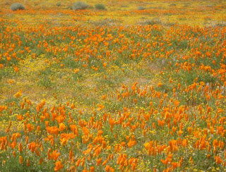


 Despite having the hunt so early one of Bari's friends accepted our invitation to join her in the fun. Our dog Phoebe must like the scent of hard-boiled eggs, because she seemed to be in most of the pictures that were taken of the day.
 Poor Nicholas, though, had some kind of bug and didn't get to sleep until about one a.m. and was still feeling it in the morning so he didn't participate until later in the day when he starting feeling better. And no, the remaining eggs weren't left outside all day waiting for him to find them.
 Three hours after Bari had gathered her last egg I was set up and ready to go at the EJ Bowl launch in Santa Barbara. That's my usual flying partner's (Tony Deleo) VR in front of my Litespeed.
 Both the RR and the Thermal Factory were working fine -- although, as you can see I had to search a bit before dialing into something above the latter.
 Romero wasn't that much different than Montecito, but I didn't have to hang around as long. Out front Tony was getting up at Castle Ridge so I left a little lower than I normally would (note the strong west drift at Romero). Didn't find anything on the spine that Tony was climbing out on so I continued on to the next one down the line where I found my strongest thermal since leaving launch which enabled me to get ahead of the Atos.


 I usually stay out on the front points in Ojai, but because I had the altitude I decided to step back to the high ground at Chief's Peak; it wasn't worth it. I ended up having to angle back out front on my way to Boyd's. Normally Boyd's can be counted on to get you high enough for the glide to Santa Paula Peak but not on this day; nearby Puckers, however, was going off.
  With light NE winds, the hope going into the day was to eke into Ojai from Santa Barbara and then work the NE/SW convergence to points east once we got to the Santa Clara river basin. Unfortunately, the sea breeze didn't over power the offshore stuff as far inland as we had hoped. Both Tony and I left the east side of Santa Paula Peak in the mid 7s with a west drift, but at 3:00 it was still blowing east at 15 mph in nearby Fillmore. In front of me, after getting tired of bucking a headwind, Tony opted to turn around at the 50 mile mark and land in Fillmore. Of course, I had to at least match that, but instead of turning around I tried to stretch out my flight as far as possible. I landed at the 50.64 mile mark. At 4 o'clock it was still blowing east in the LZ.


 Monday was not post-frontal, but the forecast called for the same type of conditions: a steep lapse rate to about 6k with a lot of moisture; the winds were predicted to be WNW in the mid-teens above 4k and about 10 knots below that. If anything it looked like I would at least have Bates to fall back on if Santa Barbara didn’t work. And since I hadn’t flown since the end of October I decided that I was going to go up and give it a shot no matter what.


