Friday, November 13, 2015

Fall flying

Just a catch up post. I've had two flights since my last entry; neither one was very special. In September I flew Pine, but couldn't get established in the Antelope Valley and landed a little over 30 miles out. Last month I flew Santa Barbara but flushed off of Castle Ridge.

 Below are some pictures from the Pine flight and a video from Santa Barbara.


Tom couldn't join us so he drove instead


PINE


Launch


Crossing the "Badlands"


Lockwood Valley


Tuesday, April 7, 2015

Santa Barbara 58 Miles

Geez, no flights through the Casitas Pass in at least five years and now two in two weeks. And I wasn't even planning on flying. Bates was showing some potential for Sunday, the 5th so I was thinking that I would fly then. After a nice long XC flight two weeks ago I was looking for a change of pace. Saturday looked OK for the mountains, but not all that spectacular. The plan for the day was to do some yard work. I was actually at Home Depot picking up some sod when Tom Truax called to tell me that I should be heading up to Santa Barbara instead; that it could be a record setting day.

I should note here that even though I didn't think it looked like an epic day, I did text another pilot before heading to Home Depot that he should consider flying this day rather than wait to fly Bates with me on Sunday. Of course, the pilot, Todd Quayle, called me too to get me to come up.

Let's see...It's 7:30 now...realistically, after dropping off the sod and getting ready, I wouldn't be out the door until at least 8:30...an hour to pick up him and at least another hour to launch...half hour to set up...hmm, 11:00 launch...that's not so bad...I'm in. Wait, do we have logistics? No. While contemplating whether or not it would be worth the hassle Tony Deleo called to tell me how good it looked and that if worse came worse he would be willing to pick us up at the end of the day. About the same time another text came in saying, "Don't worry, we'll get you back to your truck somehow."

With such short notice, I didn't have the time to charge my radio properly. A fact that may or may not have cost me a longer flight (more later).

About half-way to picking up Todd, Tony called to let me know that an earlier appointment that he had to attend was postponed and that he would be able to drive for us.

I don't know what time it was when we finally arrived at launch. After making a couple of sidetracks it was at least an hour later than what we were thinking. Tom had already gotten a ride up with the PGS and was just getting airborne when we arrived.

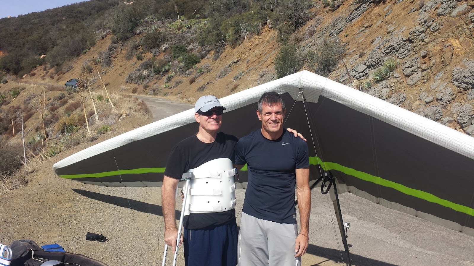
I don't know if it was caused by the scramble to get out the door or the political discussion in the truck on the way to launch, but I found myself really distracted setting up. Because of that I probably launched at least a half-hour after the first pilot, Robert Millington punched off.


Launch was good for a couple of turns, but I didn't see the point of hanging around so I took what I had and headed to the Thermal Factory. There I found a nice thermal that took me to just below 5k. Out in front, Robert and the early PGS were reporting good altitudes over Montecito Peak and the Saddle. TQ had been dealing with harness issues and was just climbing out at the Antenna Farm. No other HG planned to fly XC. For that matter, Robert wasn't going to join us XC preferring to fly an out and return instead.

Launch, Thermal Factory, Momtecito, and The Saddle
Despite getting to a nice altitude at the Thermal Factory and the reports from the pilots in front of me, I found nothing to stop for at Montecito Peak. Because of that I came into the Saddle well below the road cut, which oftentimes means a short flight. And that's despite the fact that the Saddle is one of the most reliable spines on the range. Of course, if a short flight was my fate there wouldn't be this blog entry. Even though I came in lower than my last flight I left higher. Somewhere in the high 4s.

Castle Ridge
To be honest I didn't find this flight all that fun. The air was very choppy in spots with punchy thermals. No more so than the stretch between Castle Ridge and the Powerline Crossing. I never really got high. Only gaining enough altitude in broken lift to make a play for the next spine down the line. Along the way Robert past me heading back the other way from his Whiteledge turnpoint.

Powerlines, Noon Peak and Divide Peak
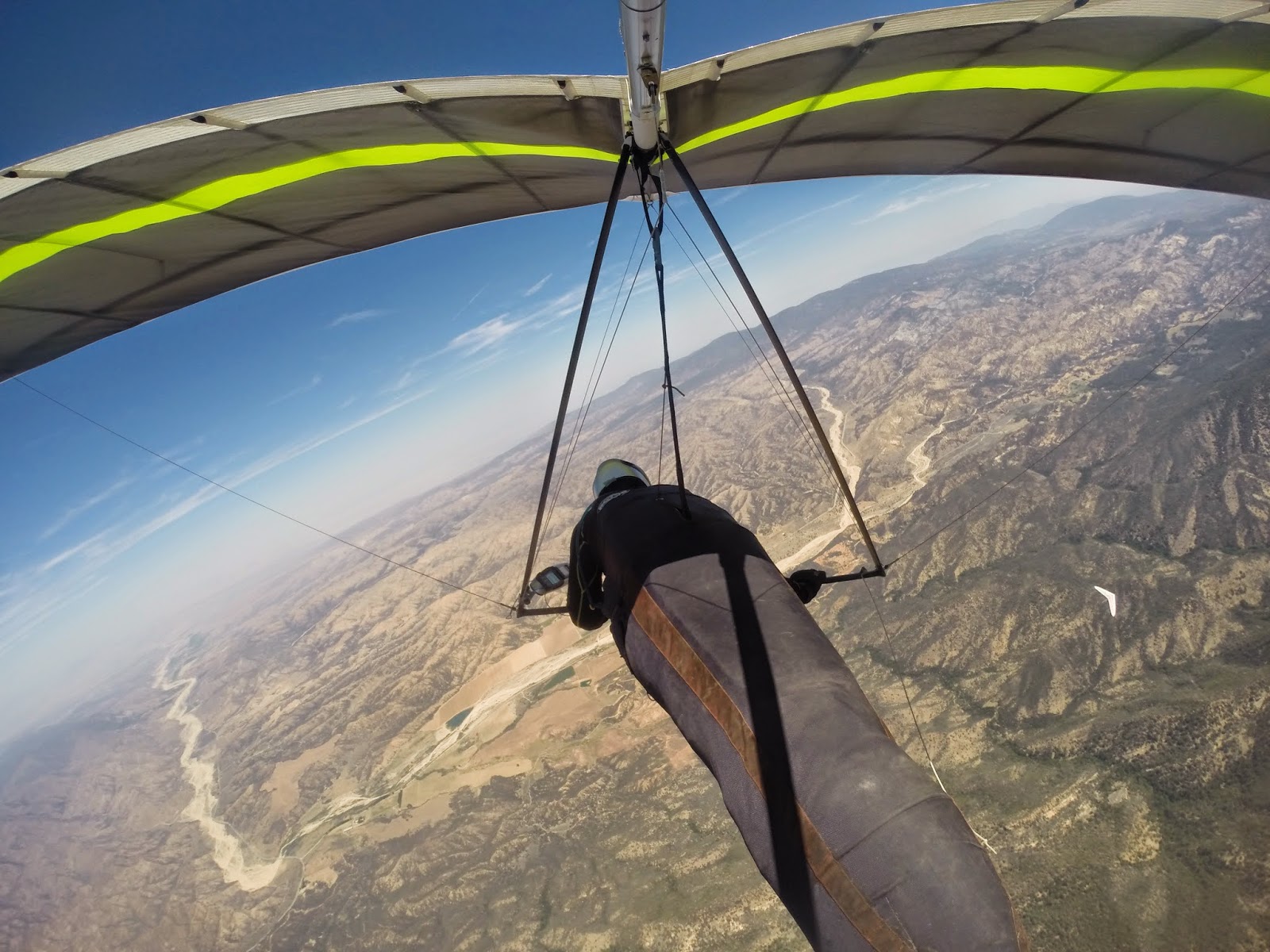
Things did open up a bit near the Powerlines and I was able to fly over to Noon Peak comfortably. There I had a quick climb to 5k, before heading to Divide and the start of the Casitas Pass (at about the same time my radio went dead). Divide worked great as did Whitledge (note on my track where I found the thermal).

Whiteledge
On my last flight I had one of my best climbs just short of Bump 3, the usual go to spot; I was able to make it all the way to Nordoff on the glide. Not only did I not get up at the same spot on this flight, but Bump 3 wasn't working either. It would take four thermals on various spines to get to Nordoff this time...and at a much lower altitude.

Bump 3 to Nordoff
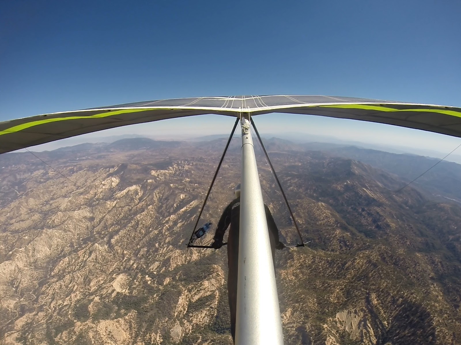
Whereas on my last flight I opted to not spend a lot of time working the turbulent lift found here, I had no choice but to stop this time if I wanted to continue on. As it turned out I made it to the Chiefs' spine in about the same position for both flights. But, instead of flushing off this time Chief's was producing more like a typical a day. Soon I was over West Repeater topping out close to 8k, the highest point of the day. High enough to head to Santa Paula Peak directly (I did fly over the Bluffs but didn't find anything worth stopping for).

Getting High at West Repeater
I past my first PG near the 33; I met up with my second one on the west corner of Santa Paula Peak (most landed in Ojai) where we shared a nice thermal, but one that didn't get us very high. My last flight spoiled me. Having gotten up to close to 9k just a bit east of where I was I didn't feel the need to go searching for the lift when I lost it. I was high enough to get to where I found my thermal during my last flight. Only this time it wasn't there. I ended up flying off the mountain below 5k. Instead of flying all the way past Piru on a glide, I would now have to work the lift over the foothills above Fillmore if I wanted to continue.

No Love at Santa Paula Peak
Nothing on the west end of the foothills, but as I worked south toward the 126 I found a low leaner right before the start of the river basin. Down below 1000 ft AGL I managed to make my way back to the mid 4s.

Fillmore
In Piru I found another low leaner, but instead of drifting me due east it had more south in it and was taking me back to the lake. Not liking my trajectory I opted to head east on a glide rather than search for the lift again after falling out of it. At this point I was actually higher than I was at the same spot during my last flight. Despite the different ways of getting there I actually hit the same spot where I found my last thermal of the day during my last flight at the same altitude. Only this time I didn't connect. There was lift there; I just didn't make it happen. Not long after that I was on the ground.

Comparing the end of the two flights


Not to make excuses, but I wasn't feeling all that well toward the end of the flight and I just wasn't up to doing what it would take to make it work. But this is where not having a radio didn't help matters. Tom had been in the same area at the same altitude right before me. But he hung in there and found enough cohesive lift to eventually take him to over 7k. He would eventually go on to fly into the Antelope Valley and break the site PG record with a 94 mile (straight line) flight. Had I heard his progress I might have been a little more focused. Having said that, I would not have attempted to follow him into the Antelope. Interstate 5 would have been it for me. At 58 miles I fell 4 miles short.  


Sunday, March 22, 2015

EJ Bowl to Soledad Canyon

I really can't remember the last time that I've flown through the Casitas Pass from Santa Barbara. It must be at least 5 years. Generally speaking, unless there is a strong east wind, if you make it through the Pass you've got at least Santa Paula made. One year way back when I made it to at least Santa Paula 5 times. Since then, seasons have gone by where I haven't made it though at all. On days that have potential it's either too strong north or cloud base is too low or in the case of Santa Ana conditions, too east to go anywhere. In other words, everything has to align just right and that just doesn't happen that often, especially when your flying is limited to weekends.

Sunday it was neither post-frontal nor Santa Ana, two conditions where Santa Barbara works the best. However, the weatherman was calling for record high temperatures. All the models were calling for at least 7k tops for Ojai and light SW winds through the boundary layer. But, and there is always a but, there was a prediction of a high cloud deck. How would it affect the rest of the forecast?

For me, it didn't matter. My daughter is back for spring break and she brought a couple of her friends with her. One of the things that she wanted to do with them was chase for me. Sunday looked as good a day as any.


Three potential drivers, but no one to drive for. The high clouds kept everyone home, including the person who would have been my flying partner for the day, but, had a change of heart between the time we left the house and the time we showed up at his doorstep. I made one other phone call when we got into Santa Barbara, but still no takers.


We arrived at EJ Bowl all alone around 10. Considering the recent time change it was early regardless of the thick cloud cover. But, it left plenty of time for the blue hole to the west of us to work its way over to us and still have the time for a good flight. It took 3 hours. Ladies, welcome to hang waiting. In the interim, a truck load of PGS showed up to fly. However, none wanted to wait for the sun to arrive and all flushed off the hill in the shade. By the time I launched around 1:00, after waiting for the sun line to bathe the RR for a bit, I was the only one left around.

R and R
Before launching I told my daughter that I'd know right away whether we were going to have an early lunch on Stern's Wharf or a chase towards home. After two or three 360s above the RR I got on the radio to tell her to get on the freeway and point the truck south. Low 4s at the RR and then again at the Thermal Factory. The shade line was just to the east of me so I had to stop and hang out on the east spine of Montecito Peak and then again at the Romero Saddle to wait for the sun to hit the next spine down the road. However, once Castle Ridge brightened I didn't run into the shade line again until near the end of my flight.

Start of the Casitas Pass
All the usual points worked perfectly fine until the last spine before the powerlines. There I hit one of the best thermals of the day, climbing out to the mid 7s, probably the highest that I have ever been at that spot. High enough to bypass Noon Peak completely and head directly to Divide Peak. Back to the mid 7s there for a glide through the Casitas Pass.

The climb just short of bump three

After a couple of lazy circles above Whiteledge I took my altitude and B-lined it for Bump 3. However, about half-way there I found another great thermal over a nondescript area that topped out close to 8k. From there it was basically a straight glide to the Three Stooges.

I stopped at Nordoff for a couple of turns but the air was a bit too textured for my blood. As usual Three Stooges was good enough for a skip over to Chiefs. However, despite being probably the most reliable spine on the range, I could not climb out. I was forced to fly off of Chiefs low to the foothills in front of West Repeater.

Upper Ojai
Of all the places to flush off from. Luckily I found something. Soon I was back to the mid 7s drifting to Boyds. By the time I left Puckers for Santa Paula Peak I was up to 8k. At Santa Paula Peak I got up to close to 9k, the highest point of the flight.

Close to 9k above Santa Paula Peak
I was probably too high for the thermals above Fillmore; I took my altitude to about half-way to Interstate 5 from Piru before I started to pick out landing fields. But the day was good for one more thermal.

Last climb of the day
The goal at the start of the day was the Interstate, but at 7k just short of it I set my sights for Sylmar. However, the high point between Simi Valley and Chatsworth was completely shaded in and after testing my glide angle toward Sylmar, 7k just wasn't quite high enough to clear the San Gabriels. 500 ft. more probably would have done it. Now in the shade, I took whatever altitude I had left and stretched a glide to Soledad Canyon, landing at Sand Canyon Road at the 14. The flight measured out 73 miles, my longest from Santa Barbara.


Monday, January 5, 2015

Santa Barbara New Years Day 2015

Sorry, I'm getting lazy in my old age. YouTube and a couple of track logs will have to do. The original thought was to do an out and return to Whitledge with idea of landing back at Santa Barbara's training hill at Elinng's Park. However, with a pretty good turnout for the New Years fly-in I didn't get off the hill until about 12:45. Thinking that it was too late to make it back from Whiteledge I opted to turn around at the power line crossing, a peak or two short of the Casitas Pass.  My flying partner, Jonathan Deitch, decided to stay with the original plan. He made it to Whiteledge but opted to land at the beach on the return trip.


Saturday, November 15, 2014

Ojai 11/8

Sorry, too lazy to write the flight up. YouTube will tell most of the story.


The struggle to get atop Whiteledge


The plan was to land at the beach in Santa Barbara. But after struggling mightily to get above Whiteledge the thought turned to any ole beach. Got to the west end of what is known as the Powerline ridge in good shape, but after my experience in Ojai the thought was that continuing on would be a struggle, especially when I couldn't see anyone ahead of me, and with radio issues I couldn't hear either. Opted to fly out. I headed for the beach at Santa Claus lane but it was too crowded to land so I turned tail for an open field.

Wednesday, September 17, 2014

Pine 9/14


My LZs for my last two flights have been within 10 miles of each other. The only difference is that the second flight started 85 miles away. I didn’t do a write-up of my previous flight because there wasn’t much to write about. After 2 hours of bobbing up and down in front of Garlock I threw in the towel and landed right below launch. Sunday’s flight was a tad better.


We’ve had a heat wave here in Southern California over the last few days and the flying conditions have been just as toasty – everywhere. A few records have fallen. 

It’s not often that you see the tops on the front range match those in the desert. Because of that I was looking to fly either Kagel or Crestline, for no other reason than to defend my Marshall/Crestline out and return record. However, my Topa buddies had no interest in dealing with the LA traffic and were heading to Pine, and my Crestline mates were either in Santa Cruz, AZ or talking about doing an out and return out into the desert.  Since the heights were the same for the desert and the front range it made more sense to me to fly along the San Gabriels, considering the fact that the LA Basin floor is 3,000 ft. lower. I’m sure I could have convinced them to see it my way, but when the late Saturday night forecast didn’t quite match what I was seeing earlier, I opted for the safer call and joined the Topa crew at Pine.

Let me backtrack a bit here. As I mention, conditions looked good everywhere, and that included the Topatopa range in Ojai. It looked like it would be good enough to go OTB into the desert, a flight that only has been accomplished on a few occasions; once by yours truly. Unfortunately, you need a permit to fly Ojai and it’s hunting season; there was not one left to be had. However, the PGers have a hike-up launch known as the Nuthouse. Three intrepid souls opted to brave the 107 degree heat and go there, including Tom Truax who would go on to fly 111 miles, breaking the site record.


Although the forecast looked great the tops weren’t expected to be terribly high. Somewhere in the 12-13k range. Also, the winds at Pine had a bit more south than what you would like for a flight out into the desert. One of the reasons the PGs opted for Ojai instead. One thing that I didn’t see in the forecast was a call for mid to high level clouds. There was a slug of it right above launch when we arrived. There also a few lennys mixed in for good measure.  Our optimism took a bit of a hit to say the least. But, despite the high cloud cover, cumis began forming above launch just after 11:00. Not too long after that pilots began throwing off.  There were 6 in total, two in each crew. Tony Deleo was gracious enough to drive for TQ and me.

Launch

Despite the great forecast, no one was screaming to cloudbase. John Hesch and I had the same idea to search more out front, but that ended up not working any better than what was happening above the ridge. Eventually, though, everyone got up and out. Whereas the other pilots opted to go straight over the back I decided to give Reyes a try, with the idea of staying on the front side of Pine to perhaps Decision Point before going OTB. At Reyes I made a mistake that almost cost me the flight. Not getting very high on my first climb out, I decided to take what I had and head for the Chute rather than stick around for a better thermal or continue east to Haddock. I did this despite that fact there were no clouds above the Chute, compared to everywhere else (probably because of the south wind). Sure enough, I didn’t find anything above the Chute and had to bail off low toward Dry Canyon.


Reyes

There’s a nice green valley between the Chute and the ridgeline just south the Dry Canyon. I didn’t realize, though, that the landable areas of the valley sit up on a plateau. The original idea was to work the ridge to as low as I needed to go before bailing out to land. The plateau gave me little room to spare. Down below 5k I had little choice but to give up the ridge and head back to the valley. Luckily, I blundered into something right above a ranch that got me back to 9k. Plenty high to be back in the ball game but not high enough to make the jump to Lockwood, especially in a south wind. TQ had already made the jump at that point.


Climbing out of a hole

It took a while, but I eventually found something to take me into Lockwood. TQ had reported earlier that he had found something above Boy Scout road. It was still there. I was soon close to my highest point of the day making my way to Frazier, albeit along a course line a little further north than what I would have liked given the wind direction.  


On my way to Frazier

But a little skip on the east side of Lockwood gave me enough altitude to get above Frazier comfortably. Up in front of me, though, a small fire had broken out on the NE side of the mountain. I had the altitude to fly over the air traffic dealing with the fire, but I ended up leaving Frazier lower than what I had hoped in order to clear the area has fast as I could. 


Heading out into the desert

I ended up crossing the 5 with just over 9k. My glide was on the wrong side of the cloud street, but I didn’t want to give up my precious altitude fudging more south. I had my sights set on a little foothill peak sitting in the sun right behind the cement plant, and at that point it looked like I had just enough altitude to make it. Somewhere on my glide I passed TQ, although I never saw him. He would end up landing nearby.


The Antelope Valley

I did reach the peak, but it was only good for enough altitude to continue on. Despite the clouds forming above the Tehachapis the range is a bit shallow in this area; I didn’t feel comfortable diving back to them low so I took a more southerly angle. After a series of skips, I lucked into the best thermal of the day, having the pleasure of sharing it with a redtail hawk. The lift would have taken me to cloudbase, but still being a bit wary, I opted to dive out well short of it. Still, I was close to 12k which was plenty high to step back to the ridgeline.

By this point I was the only hang glider pilot flying in the Antelope Valley. TQ had landed just north of Neenatch, and two of the other pilots landed near the 5, while the other two opted to fly north, with one flying 45 miles into the Central Valley. I was the only hang glider on the Tehachipis, but up in front of me was Tom Truax on his paraglider. He indeed made the connection into the desert from Ojai. Although I never saw him I think I passed him around the 60 mile mark, right about the time that my motion sickness kicked in. 

If you’ve read this blog before you know the routine: once I get sick I have about a 20 minute window before the second bout kicks in; if I can get on the ground before that, I’m pretty much OK. But if I have a second bout then I’m a mess for at least 2 hours after that even though I’m on the ground. So the idea is to fly as far as I can in that 20 minute window. I’m not sure how high I got in thermal when I first got sick, but I do know that I reported on the radio that I was at 7100 ft at 71 miles out. One more climb and I’d have enough altitude for my 100 miler. Soon after the radio report I hit some lift. I told myself that I was going to stay with it as long as I could despite feeling the way that I did. Unfortunately, I kept on falling out of it, and frankly, I just didn’t have the mental fortitude to stay with it. Soon after that I was on the ground.


Distance: 85.5 Miles
Duration: 3:45 hours
Max Altitude: 11,948 ft.

Monday, June 9, 2014

Pine Mountain 6/8

Nice rewarding flight from Pine yesterday despite not making goal. With an east wind we were hoping for an out and return to perhaps the cement plant near Quail Lake in the Antelope Valley, but ended up turning around at the airport on the east side of Lockwood Valley.


Just TQ an old flying friend and I were up there yesterday. Both of us in need of shaking off some rust. Driving up to launch we were a bit concerned about the wind direction as there was a pretty good north breeze all the way up to the drive up north launch. However, it was coming in nicely at the south launch when we arrived. We launched one right after the other around noon. 


Launch

It took a little while to find the ticket above the ridge line, but once there things opened up. 
Soon after I was making my way against an 8mph headwind to the Chute from about 13k. Being a bit lower Todd opted to fudge back toward launch in search of a better climb.

Climbing out with TQ behind launch

The Chute was bouyant but I seemed to lose everything I tried to turn in before completing my 360s. But I had plenty of altitude to play with so I just kept on plugging up wind along the ridge line. At about the same time that TQ announced on the radio that a cumi was forming over the ridge my vario started screaming...and didn't stop until I was just north of 14k. 


East bound from the Chute at 14k

From the east end of the Chute I worked a seam between Guillermo and Grade Valley. Once near Guilermo I angled toward it. But like the west end of the Chute the air above it was buoyant but I was unable to find something to core. Rather than stopping to search I just kept plugging forward along the foothills just south of Lockwood. The problem was the lower I got the stronger the headwind as the east was funneling through the gap between Frazier and Alamo Mountain. Below 9k just short of Frazier, I was flying against a 15mph headwind. Staying along the same line didn't seem very prudent so opted to veer north into Lockwood. 


East end of Lockwood Valley

Of course when your in the middle of the valley you just hope you might flounder into something. I never did until saw a crow start to turn circles near the airport. I headed in his direction and was rewarded with the strongest (and smoothest) thermal I've been in in long time. And then just like that it was gone. Here I was thinking that I'd get another chance at Frazier, but instead I was running downwind in the other direction back in flounder mode. I was down to about 6300 ft before picking up some scraps above Boy Scout Road. At about the same time TQ was reporting that he just gotten to Guillermo with 12k. To the west of us running north to south from the middle of Dry Canyon to the middle of the Chute a cloud street had set up along the East/West convergence line. 


Convergence line out in the distance


I just needed to get up at the end of Boy Scout and we both could B-line it to the street and then just bridge it out to Ojai. And get up I did. Once I drifted over the foothills on the west end of Lockwood everything opened up. Soon I was back to 14k flying down wind to the cloud street. TQ took a slightly different line that didn't work quite as well, but he had no problem making it to the convergence line.


To make my flight more of a triangle I opted to head to the cloud that was farthest to the north. It was about halfway up Dry Canyon. I found something nearby that got me close to base and then after that I headed due south along the convergence line. Again the air was buoyant but I never really found something to stop for. I turned some half ass circles above the Chute below a cloud, but at 12,500 ft I already had plenty altitude to make it out to Ojai. And that's what I did. As did TQ not much longer after me.

Distance: 47.5 Miles
Max Altitude: 14,350
Duration: 3 Hours